Purbeck 24 Off Road Ride
24miles
Length
450metres
Elevation gain
3hours 22minutes
Average time
Off Road
Ride Type
Explore the hills and heathland in the Isle of Purbeck with everything from woodland singletrack to open forest tracks to explore.
The route starts at the north end of Swanage with a steep climb on road before a long descent across Studland Heath past Aglestone Rock. A flat ride along the edge of Poole Harbour and some forest tracks take you to the western end of the ride at Furzebrook.
A short road section takes you to a single-track through dense woodland and out to the historic Corfe Castle. A long climb up to Kingston and some more road miles before you reach Worth Matravers and a long down hill section on Priests Way back to Swanage.
Start:
Start from layby on Ulwell Road at the Welcome to Swanage signs
SZ 02171 80919
These routes have been recorded using a Garmin GPS unit. We cannot guarantee the accuracy of the available data files due to differences between GPS devices.
Route
Start of Ride
Elevation: 51 metres
OS Grid Reference: SZ 02177 80913
Lat, long: 50.62791, -1.97058
Start in the Layby on Ulwell Road, Exit the layby and turn right towards Studland
Ulwell Road Junction
Elevation: 67 metres
OS Grid Reference: SZ 01812 81219
Lat, long: 50.63066, -1.97574
Turn left at the junction marked Corfe Castle 4 and follow the road up the hill to the T Junction
B3351 T Junction
Elevation: 108 metres
OS Grid Reference: SZ 01240 81794
Lat, long: 50.63584, -1.98383
Turn right at the T junction and follow the road towards Studland past the Golf Course until you come to a small parking area on your left and a wooden gate with a bridleway sign.
B3351 and bridleway
Elevation: 119 metres
OS Grid Reference: SZ 01709 81873
Lat, long: 50.63654, -1.97720
Turn left and go through the wooden gate and follow the track heading North alongside the golf course following signs for Agglestone Rock until you come to a set of double wooden gates
Double Wood Gates
Elevation: 77 metres
OS Grid Reference: SZ 02082 82453
Lat, long: 50.64176, -1.97192
At the double wooden gates continue straight ahead on the wide gravel/stone track heading north and follow the wide track down to Agglestone Rock.
Agglestone Rock
Elevation: 47 metres
OS Grid Reference: SZ 02325 82765
Lat, long: 50.64457, -1.96848
At Agglestone Rock turn left just before you reach the rock and follow the wide track turning right at the next junction and right again at the next path junction until you come to a cross roads.
Cross Roads
Elevation: 35 metres
OS Grid Reference: SZ 02449 83271
Lat, long: 50.64912, -1.96672
At the cross road, continue straight ahead and continue heading North on the wide track to the Ferry Road gate
Ferry Road Junction
Elevation: 8 metres
OS Grid Reference: SZ 02527 84340
Lat, long: 50.65873, -1.96561
At the Ferry Road, go through the gate and turn left following the wide track along the edge of Poole Harbour until you come to a junction with a farm on your right.
Farm Junction
Elevation: 6 metres
OS Grid Reference: SZ 01869 84574
Lat, long: 50.66083, -1.97492
Turn left and follow the wide track around to your right and down a small hill to a river crossing and up to the next gate.
Gate
Elevation: 2 metres
OS Grid Reference: SZ 01596 84532
Lat, long: 50.66046, -1.97878
Go through the gate (sometimes tied open) and follow the wide track keeping to the left at the next junctions until you come to a tarmac road.
Tarmac road Junction
Elevation: 14 metres
OS Grid Reference: SZ 01071 84869
Lat, long: 50.66350, -1.98621
Turn left onto the Tarmac Road and continue until the next Right turn with a junction on your right side.
Junction
Elevation: 22 metres
OS Grid Reference: SZ 00822 84867
Lat, long: 50.66347, -1.98973
Turn right and follow the rough track down a small hill until you come to a junction with the main path going left and a house ahead.
Junction
Elevation: 7 metres
OS Grid Reference: SZ 00509 85029
Lat, long: 50.66493, -1.99417
Turn left and then turn right as the track follows the edge of the trees to a gate.
Gate
Elevation: 7 metres
OS Grid Reference: SZ 00406 85029
Lat, long: 50.66493, -1.99562
Go straight ahead at the gate and follow the path across the open fields until you come to a metal gate and junction with a wide track.
Gate and Junction
Elevation: 10 metres
OS Grid Reference: SY 99779 85337
Lat, long: 50.66770, -2.00449
Go though the gate and turn left on the wide track down to a cross roads and continue straight ahead until you come to a junction with a tarmac road
Junction and Tarmac road
Elevation: 20 metres
OS Grid Reference: SY 99245 84781
Lat, long: 50.66270, -2.01204
Turn left onto the tarmac road at the stepped cross road and then right onto the bridleway following the wide sandy track though the trees until you come to a gate at the next road.
Gate and road
Elevation: 19 metres
OS Grid Reference: SY 98386 84099
Lat, long: 50.65657, -2.02420
Go though the gate and follow the road past farm buildings until you come to a T junction.
Meaduss Lane Junction
Elevation: 29 metres
OS Grid Reference: SY 97780 83806
Lat, long: 50.65392, -2.03277
Turn right and follow the narrow road up a small hill and left until the next T junction
Thrashers Lane T Junction
Elevation: 20 metres
OS Grid Reference: SY 97349 84104
Lat, long: 50.65661, -2.03887
At Thrashers Lane cross the junction to a metal gate and then bear right along the bridleway to the next cross roads with a tarmac road and metal gate.
BP road Junction
Elevation: 21 metres
OS Grid Reference: SY 97123 84402
Lat, long: 50.65929, -2.04206
Go through the metal gate, across the road and next metal gate and follow the bridleway to the next gate and across the open fields down to a stone bridge with two wooden gates (can be very wet in winter)
Wooden Gate and Stone Bridge
Elevation: 3 metres
OS Grid Reference: SY 96673 84763
Lat, long: 50.66253, -2.04844
Go through the wooden gates across the stone bridge and straight across the next field following the bridleway to the next wooden gate and small wood bridge. Go across the bridge and follow the narrow track to the next gate and open heathland.
Gate and Heathland
Elevation: 6 metres
OS Grid Reference: SY 96394 84928
Lat, long: 50.66401, -2.05238
Turn left at the gate then right after approx 20m and continue to the narrow tarmac road. There is a small parking area with wooden posts on the opposite side of the road with a narrow path heading West.
Road crossing
Elevation: 6 metres
OS Grid Reference: SY 96292 84968
Lat, long: 50.66437, -2.05382
Go across the road and follow a narrow path heading West until it forks to the right at a 45 degree angle. Follow this narrow path until you come to a raised wide gravel path. This is the old clayworks railway line.
Middlebere Tramway/Hartland Way
Elevation: 8 metres
OS Grid Reference: SY 96074 85038
Lat, long: 50.66500, -2.05691
Turn left on to the old tramway and follow the path until it comes to a Y junction with a gate on your left and sandy narrow track to the right.
Middlebere Tramway/Hartland Way Y Junction
Elevation: 11 metres
OS Grid Reference: SY 95419 84683
Lat, long: 50.66180, -2.06618
Bear right a the Y junction and follow the sandy track on across the open heathland until the track turns right. Continue along the track past the next Y junction and then turn left at the next track T junction.
T Junction
OS Grid Reference: SY 94665 84999
Lat, long: 50.66463, -2.07685
Turn left and follow the track across the heathland until you come to wooden gates and Soldiers Road
Soldiers Road Gate
OS Grid Reference: SY 94030 84847
Lat, long: 50.66326, -2.08584
At the wooden gate go though the gate and turn left onto Soldiers Road. Continue to the T junction with the A351
A351 and Soldiers Road Junction
OS Grid Reference: SY 93909 84181
Lat, long: 50.65727, -2.08753
Turn right onto the A351 (Caution this road is very busy and take care when crossing the road) and follow the road for approx 120m until you come to a narrow entrance on the left with a bridleway sign.
A351 and Bridleway
OS Grid Reference: SY 93830 84269
Lat, long: 50.65807, -2.08865
Turn left and follow the narrow bridleway heading west down a small hill, cross very wet boggy section and then following the narrow path past gorse bushes until you come to a rough road and junction under the railway.
Railway bridge and bridleway crossing
OS Grid Reference: SY 93461 83983
Lat, long: 50.65549, -2.09386
Turn left under the railway bridge then right onto the signposted bridleway and continue along this bridleway until you come to the Furzebrook Road.An alternative route for sections 29 and 30 which can be muddy in winter is to continue along the A351 heading North until the next roundabout then turn left heading South along the Furzebrook Road.
Furzebrook Road
OS Grid Reference: SY 93146 83857
Lat, long: 50.65435, -2.09832
Turn left onto the Furzebrook Road and continue along the road until you come to a turning on your left with a bridleway sign for Norden.
Junction for Norden Singletrack
OS Grid Reference: SY 93279 82843
Lat, long: 50.64523, -2.09641
Turn left onto the narrow singletrack trail and keep to the right at the footpath junctions along the trail going over a wooden bridge and continue heading East until you come to Norden Farm.
Norden Farm
OS Grid Reference: SY 94728 82923
Lat, long: 50.64596, -2.07592
Turn right and follow the farm roads to your left going past the camping areas and through the farm buildings until you come to a T junction with the A351.
A351 Junction
OS Grid Reference: SY 95247 82902
Lat, long: 50.64578, -2.06859
Turn right onto the A351 and follow the road across the next roundabout and down to Corfe Castle. Follow the road as it turns right up past the Castle until you come to the village square on your right side. Please note this road is very busy during the summer months.
East Street and The Square
OS Grid Reference: SY 96060 82093
Lat, long: 50.63852, -2.05708
Turn right in to the village square and left onto West Street following the narrow road heading South through the village. There are several cafes and pubs so this is a ideal time for a break and some food and drink (non alcoholic!)
West Street Start of Corfe Common
OS Grid Reference: SY 95841 81359
Lat, long: 50.63191, -2.06017
At the end of West Street go straight ahead over the cattle grid and follow the narrow road across the common over the next cattle grid until you come to farm buildings with a large water wheel on your left side.
Farm Buildings
OS Grid Reference: SY 95111 80282
Lat, long: 50.62222, -2.07048
Go though the farm yard past the large water wheel and follow the track which bears right past the farm and then left up a rough track heading North/East until you come to a gate on your left into woodland.
Gate and woodland track
OS Grid Reference: SY 95174 79694
Lat, long: 50.61693, -2.06957
Go though the gate and follow the woodland track up the hill until you come to a Y junction with a tarmac road.
Junction with West Street
OS Grid Reference: SY 95490 79569
Lat, long: 50.61582, -2.06511
Turn left onto West Street in Kingston and follow the road down to the junction with the B3069 next to the Scott Arms pub
Kingston Hill and West Street
OS Grid Reference: SY 95721 79629
Lat, long: 50.61635, -2.06185
Turn right / straight head at the junction and follow the B3069 until you come to a T junction on the right with a sign post for Worth Matravers 1
B3069 Junction to Worth Matravers
OS Grid Reference: SY 97169 79120
Lat, long: 50.61178, -2.04138
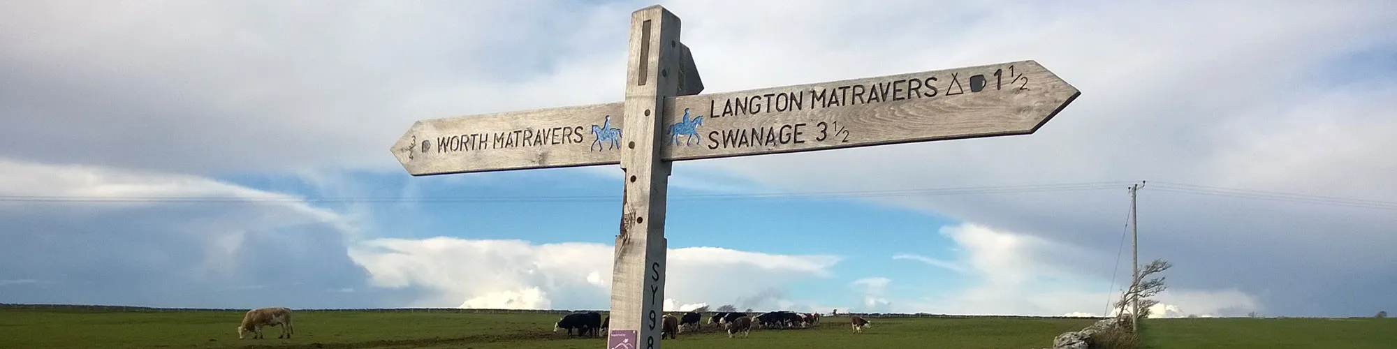
Turn right at the junction and follow the road to the village of Worth Matravers and the junction next to the Square and Compass pub. This is a very popular pub for walkers and cyclists.
Y Junction at Square and Compass Pub
OS Grid Reference: SY 97441 77518
Lat, long: 50.59738, -2.03751
Turn left and continue up the hill though the village until you come to a bridleway on your right with a wooden gate which is set back from the road.
Priests Way bridleway
OS Grid Reference: SY 97955 78014
Lat, long: 50.60185, -2.03026
Turn right and go though the gate crossing the open field and follow the wide track heading east towards Swanage. There are several gates on this track and it is often busy with walkers all year. Continue along this track for approximately 2 miles until the path turns sharp left with farm buildings on your left side.
Priests Way
OS Grid Reference: SZ 00579 77912
Lat, long: 50.60093, -1.99318
Continue past the farm buildings and follow the wide track as it turns left around the field and down to a wide gate and Y Junction
Gate and Y Junction
OS Grid Reference: SZ 00741 78126
Lat, long: 50.60286, -1.99089
Go through the gate and turn right up a small hill and follow the bridleway signs through three more gates until you come to a cross roads with a signpost for Swanage.
Junction
OS Grid Reference: SZ 01540 78250
Lat, long: 50.60397, -1.97960
Turn left and follow the narrow bridleway down the hill alongside an open field on your right until you come to a cross roads junction.
Cross roads junction
OS Grid Reference: SZ 01572 78513
Lat, long: 50.60633, -1.97915
Turn right and follow the narrow track heading east until you come to the junction with Priests Road.
Junction Purbeck View and Priests Way
OS Grid Reference: SZ 01906 78582
Lat, long: 50.60695, -1.97443
Turn left and then straight ahead at the next junction onto Priests Road. Follow Priests Road until you come to the junction with Gordon Road on your left.
Gordon Road and Priests Road
OS Grid Reference: SZ 02343 78695
Lat, long: 50.60796, -1.96825
Turn left down Gordon Road
High Street and Gordon Road
OS Grid Reference: SZ 02375 78766
Lat, long: 50.60861, -1.96780
Turn Right onto the High Street and follow the road down Court Road to the right turn at the bottom of the hill with a junction on your left and also straight ahead onto Court Road.
Kings Road West and Court Road
OS Grid Reference: SZ 02502 78854
Lat, long: 50.60940, -1.96599
Continue straight ahead at the bottom of Court Road and follow the road up a small hill to a junction with a stone bridge overlooking the railway.
Court Road and Northbrook Road
OS Grid Reference: SZ 02682 78897
Lat, long: 50.60979, -1.96346
Turn left over the bridge and follow Northbrook road heading North to the junction with Victoria Avenue.
Northbrook Road and Victoria Avenue
OS Grid Reference: SZ 02748 79105
Lat, long: 50.61165, -1.96252
Continue straight ahead at Victoria Avenue onto Northbrook Road and continue heading North until you come to a mini roundabout.
Northbrook Road and Darkie Lane
OS Grid Reference: SZ 02455 80298
Lat, long: 50.62238, -1.96666
Go straight ahead at the roundabout and onto Darkie Lane. Continue up the hill and right past a caravan park until you come to the junction with Ulwell Road.
Ulwell Road and Darkie Lane
OS Grid Reference: SZ 02230 80818
Lat, long: 50.62706, -1.96984
Turn left onto Ulwell Road then right into the layby to complete the ride.
Elevation Chart and Map
Move your mouse over the elevation line to view the location on the route map.
Walker & Cyclist Friendly Accommodation
Whether you’re exploring scenic trails, tackling longer routes, or simply enjoying a leisurely ride, choosing the right base makes all the difference. Below you’ll find details of some of the many local accommodation businesses that understands the needs of outdoor enthusiasts, helping you relax, recharge, and get ready for your next journey.