World War 2 in Purbeck
Bombed, defended, evacuated and at the forefront of radar science, the Isle of Purbeck played an extraordinary and largely unsung role in the Second World War.
Swanage and the war
A coastline on the front line
The Isle of Purbeck was deeply affected by the Second World War, not just as a target for Luftwaffe raids, but as a place of strategic importance for coastal defence, radar development and the rehearsal of the D-Day landings.
At the outbreak of war in September 1939, Purbeck's position on the English Channel made it immediately strategically significant. The coast was fortified, beaches were mined and obstructed, and observation posts and gun emplacements were established on the high ground. The small town of Swanage endured more air raid alerts than London, and suffered significant bomb damage and civilian casualties. Meanwhile, a few miles to the west near Worth Matravers, one of the most important scientific establishments of the war was quietly changing the course of the conflict.
Coastal defences
Beaches mined, cliffs fortified
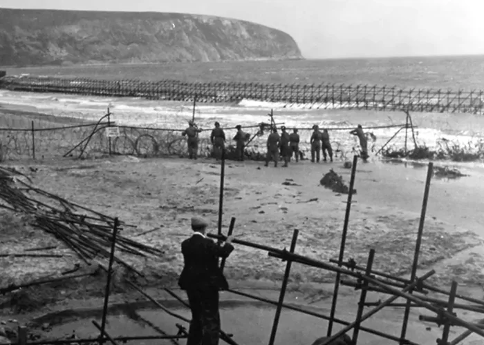
From 1940 onwards the Purbeck coastline was transformed into a defensive barrier. All beaches were covered with concrete anti-tank obstacles, square-pyramidal blocks known as "dragon's teeth", designed to slow tanks and mechanised infantry in the event of an invasion. Over 5,000 mines were laid on the beaches of Purbeck. Concrete pillboxes housing machine gun positions were installed at Studland Bay and Swanage Bay, including positions below Ballard Down at the northern end of Swanage Bay and on the southern shore between the pier and Peveril Point.
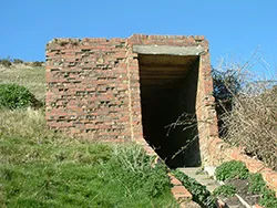
The high ground was used for observation and artillery. Gun emplacements were installed at Peveril Point on the southern headland of Swanage Bay and at Ballard Down above Old Harry Rocks. Ballard Down's obelisk, a nineteenth-century navigational landmark, was dismantled in 1940 on the grounds that enemy pilots might use it as a navigation aid. The obelisk was partly rebuilt in 1973 but at a reduced height, with one original section left standing alongside it. Observation posts were built all along the coast, several of which can still be found on Studland Heath embedded in the gorse and heather.
The bombing of Swanage
Air raids, more alerts than London
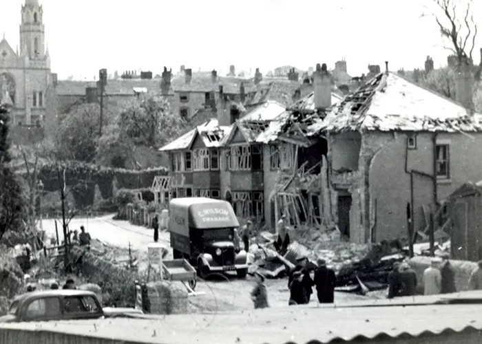
Swanage was attacked multiple times by the German Luftwaffe, with the most destructive raids concentrated in 1942. In total the town received more air raid alerts than London, and suffered 20 deaths across the course of the war. The raids were typically carried out by small numbers of fast low-flying aircraft, Junkers Ju 87 Stuka dive-bombers, Messerschmitt Bf 109 fighters and later Focke-Wulf Fw 190 fighter-bombers, which flew in low over the coast to avoid detection.
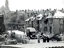
The most destructive single attack came on 17 August 1942, when a formation of Focke-Wulf 190s flew in over Old Harry Rocks and swept across the town, strafing people on the beach with machine gun fire before bombing the centre. A direct hit on the Westminster Bank on Institute Road killed the bank manager and his wife. A photographic studio and café were badly damaged. Eight people died and thirty-nine were wounded. Further bombs fell on Chapel Lane, Church Hill and the Narrows in the High Street, demolishing several houses; the site was later rebuilt as the Swanage Day Centre.
Other significant attacks included a strike on 20 April 1942 that damaged houses on Cornwall Road and commercial buildings on Station Road; a raid on 14 May 1942 that damaged Wesley's Cottage in the High Street (named after John Wesley, who visited Swanage in 1774, 1776 and 1787); a 13 July 1942 attack that injured three people in Park Road; and a 23 August 1942 raid on the town centre that killed five people and wounded nine, damaging buildings around the Square including the Ship Inn.
The radar revolution
Worth Matravers, birthplace of modern radar
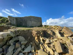
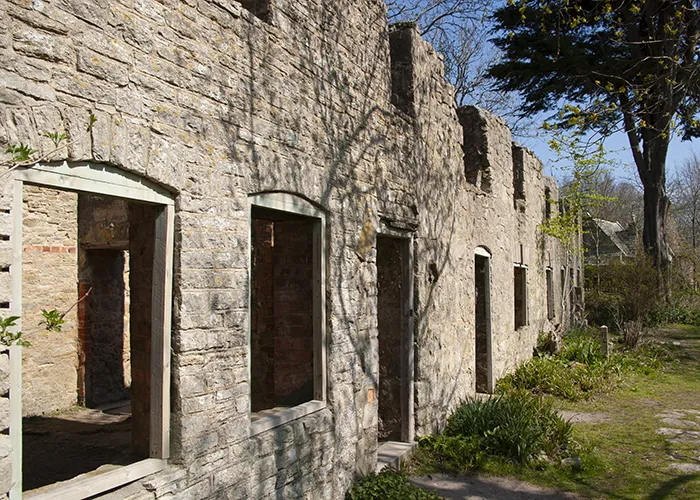
The Isle of Purbeck's most historically significant wartime role was as the home of the Telecommunications Research Establishment (TRE), Britain's central organisation for the development of radar and radio navigation during the war. The establishment moved to Worth Matravers, on the clifftop above the Channel about four miles west of Swanage, in May 1940, relocating from Dundee in Scotland to take advantage of the views over the English Channel and proximity to other research teams.
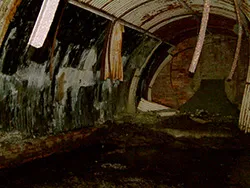
At Worth Matravers the scientists, at peak staffing around 2,000 people, developed the technologies that would help win the war in the air. This included the development of airborne interception radar (allowing night fighters to locate enemy aircraft in the dark), the GEE navigation system used by Bomber Command from 1942, and advances in centimetric radar using the cavity magnetron (developed at Birmingham University in 1940) that were transformative for both aircraft and anti-submarine warfare. A 110-metre transmitter tower was erected on the clifftop to broadcast test radar signals.
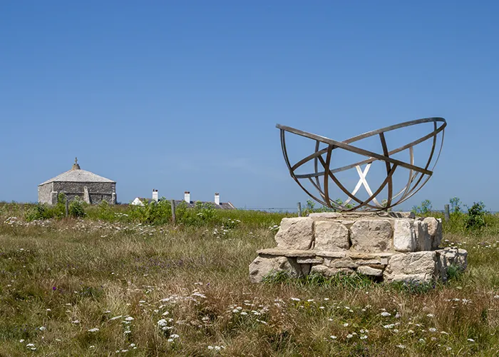
After the successful British commando raid on the German radar station at Bruneval in February 1942, in which a TRE scientist participated and German radar components were captured, British commanders grew concerned that the Germans might attempt a retaliatory raid on Worth Matravers. When intelligence suggested German paratroopers were being readied, TRE was hastily relocated to Malvern College in Worcestershire in May 1942. The radar tower remained in operation with the RAF for several years after the war before being demolished in the early 1970s. Today a stone memorial at St Aldhelm's Head marks the site of this remarkable establishment.
Rehearsing D-Day
Exercise Smash & Fort Henry
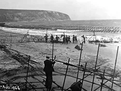
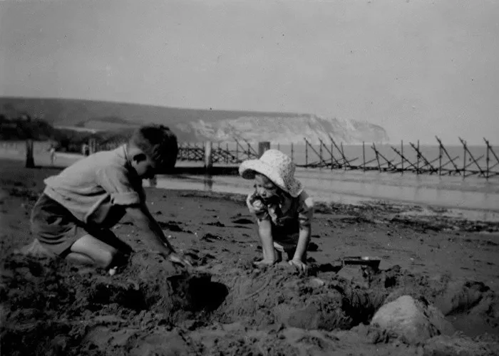
As planning for the Normandy landings accelerated, a suitable site was needed to rehearse the invasion technique on beaches similar to those in northern France. Studland Beach, with its long sandy shore and gently shelving approach, was chosen for a series of exercises under the collective title Exercise Smash, carried out in April 1944.
During the exercises, British infantry, including the 1st Battalion of the Dorsetshire Regiment, made amphibious landings from the sea using landing craft, while the beach was subjected to live bombardment from offshore warships (including cruisers and destroyers) and aerial attack from British and American aircraft using bombs and rockets. The use of live ammunition was intended to accustom troops to the chaos of an actual beach landing. Semi-submersible Valentine tanks (fitted with flotation screens to allow them to swim ashore) were used; several of these sank in the bay and remain on the seabed today. Tragically, a crew of six men drowned when their tank went down.
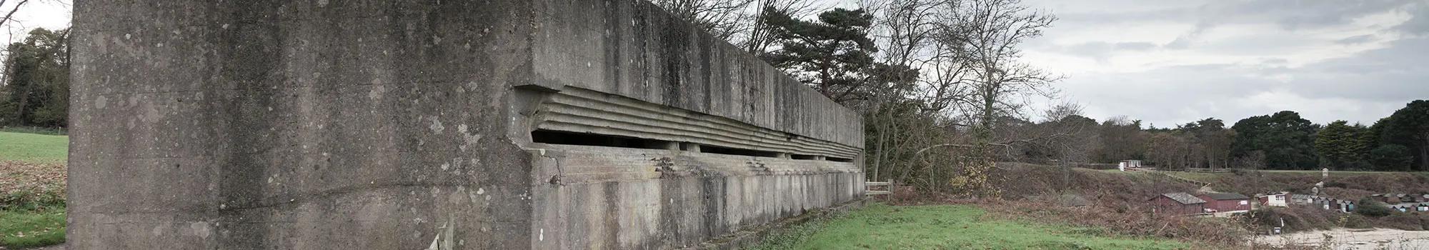
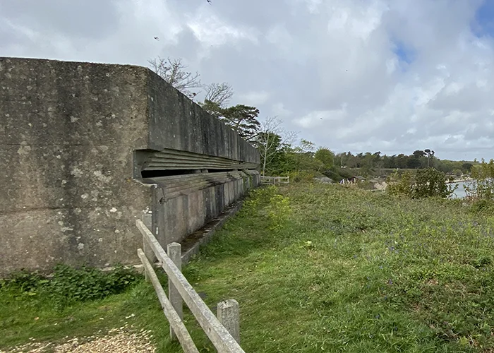
Overlooking the bay from the hilltop above Studland Manor House Hotel stands Fort Henry, the largest and most heavily constructed observation post built in Britain during the war. It was used during Exercise Smash by a remarkable group of observers: King George VI, Prime Minister Winston Churchill and General Dwight Eisenhower (Supreme Commander of Allied Forces) all watched the rehearsal landings from its windows. Fort Henry still stands today and can be reached via a footpath south of Middle Beach car park in Studland.
The lost village
Tyneham, evacuated & never returned
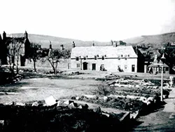
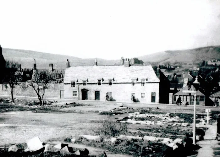
Tyneham is a small village in west Purbeck, about ten miles west of Swanage, whose medieval origins are clear in its church, manor house and farm buildings. In November 1943 the War Office requisitioned the entire village and the surrounding 3,000-acre estate to create a live-fire training range for troops preparing for D-Day and subsequent operations. The 252 residents were given just days to leave their homes with whatever possessions they could carry; a now-famous note pinned to the church door read: "Please treat the church and houses with care; we have given up our homes where many of us lived for generations to help win the war to keep men free. We shall return one day and thank you for treating the village kindly."
They never did return. In 1948 the army placed a compulsory purchase order on the land, and Tyneham remains part of the Lulworth Ranges military training area to this day. The village is open to visitors on most weekends and public holidays when firing is not taking place, and the empty church and schoolroom, preserved as a permanent memorial to the community, are deeply moving. The schoolroom retains the children's desks, chalkboards and artwork, frozen at the moment the village was abandoned.
After WWII
After the war, Purbeck tried to rebuild
Mines were cleared from the beaches, unexploded ordnance was recovered from the heathland (some is still being found today), most observation posts were demolished, and the town of Swanage worked to repair its bomb-damaged streets. Fort Henry and several Studland bunkers survive as reminders.
TRE at Worth Matravers, key facts
- Arrived
- May 1940 (from Dundee, Scotland)
- Previous name
- MAPRE (Ministry of Aircraft Production Research Establishment); renamed TRE November 1940
- Peak staffing
- ~2,000 people; grew to ~3,500 by 1945 at Malvern
- Key developments
- Airborne interception radar, GEE navigation system, centimetric radar (with cavity magnetron)
- Departed
- May 1942, hastily moved to Malvern College after Bruneval raid intelligence
- Memorial
- Stone memorial at St Aldhelm's Head, near Worth Matravers
Visiting wartime Purbeck
- Fort Henry is accessible via a footpath south of Middle Beach car park in Studland; follow the footpath heading south
- Several Studland Heath bunkers survive buried in gorse and heather, take care around unstable structures and do not enter unsafe interiors
- Tyneham is open most weekends and Bank Holidays when the Lulworth Ranges are not in use, check the MOD access schedule before visiting
- The radar memorial at St Aldhelm's Head is reached by the coastal path from Worth Matravers; a rewarding walk with exceptional views
- The Swanage Museum and Heritage Centre has a dedicated section on the WW2 radar development programme and on the bombing of Swanage
- Unexploded wartime ordnance is still occasionally found in Purbeck heathland, never touch or approach anything suspicious, and report it to the police
References & further reading
Sources used to verify and expand the content on this page:
- Wikipedia, Telecommunications Research Establishment (TRE established Worth Matravers May 1940, renamed TRE November 1940, Bruneval raid, move to Malvern May 1942, staffing ~2,000)
- Military Wiki, TRE (full history from Bawdsey to Dundee to Worth Matravers to Malvern, radar development timeline)
- University of Manchester, TRE history (May 1940 arrival at Worth Matravers, May 1942 departure to Malvern)
- The D Day Story, Exercise Smash (April 1944, 1st Dorsetshire Regiment, live ammunition, Valentine tanks, VIP observers)
- Dorset History Centre, Arne Starfish decoys (Holton Heath Royal Naval Cordite Factory, Starfish decoys, 1942 bombing, 200+ craters, Arne evacuation)