The Isle of Purbeck
A wedge of chalk, limestone and lowland heathland tucked into Dorset’s south-east corner, bounded by Poole Harbour, the River Frome and the open Channel, and shaped by two thousand years of stone extraction, castles and sea.
Location & Boundaries
An island in name more than water
The Isle of Purbeck occupies the south-east corner of Dorset, a roughly wedge-shaped block of chalk and limestone squeezed between the tidal waters of Poole Harbour and the open English Channel.
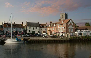
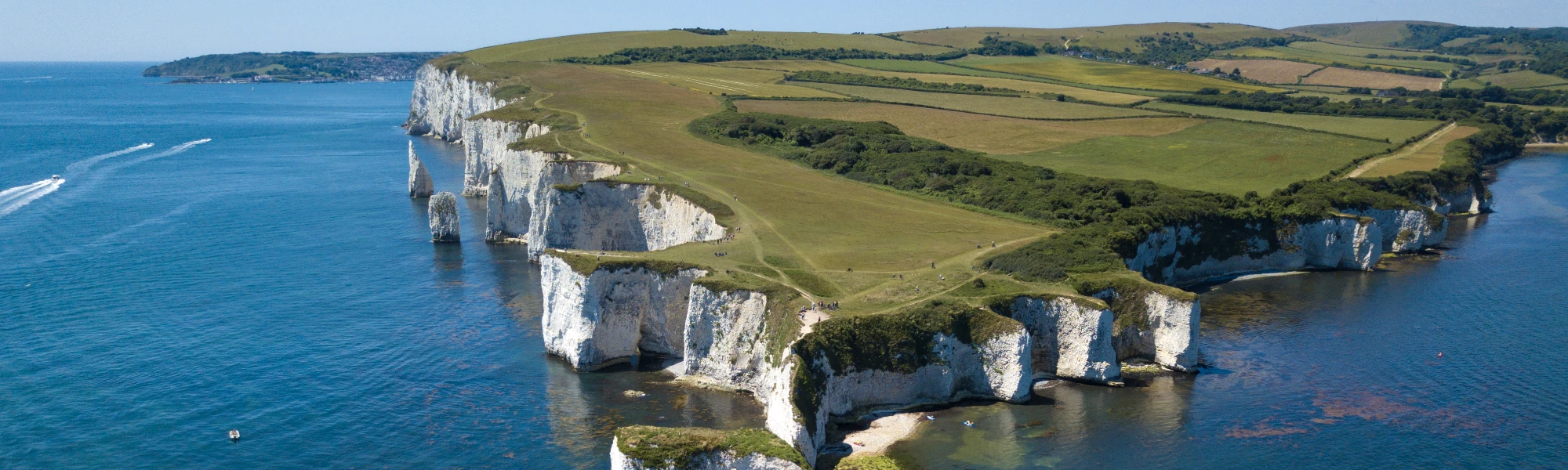
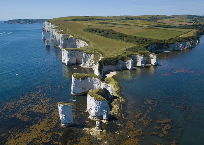
Despite the name, Purbeck is not truly an island. No continuous channel of open water cuts it off from the rest of Dorset, and where the boundary actually falls has been argued over for centuries. Its north-eastern and northern edges are set by Poole Harbour and the marshy lower reaches of the River Frome, which the peninsula’s old gateway town, Wareham, has guarded since Saxon times. To the south and east, chalk and limestone cliffs drop straight into the Channel along a coastline that runs from Studland, past Swanage and St Alban’s Head (also called St Aldhelm’s Head), to Kimmeridge Bay.
The western edge is the least settled. Medieval writers placed it at Flower’s Barrow, the Iron Age hillfort above Worbarrow Bay; the eighteenth-century historian John Hutchins instead drew the line along the Luckford Lake stream, further east. The Dorset broadcaster Ralph Wightman put it more plainly: Purbeck only reads as an island at all “if the barren heaths between Arish Mell and Wareham” are counted as cutting it off from the county around it.
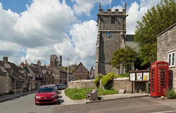
Inside that boundary, the peninsula is roughly ten miles across, folded around a spine of chalk, the Purbeck Hills, that runs east–west and rises to Swyre Head, its highest point, at 208 metres. Corfe Castle sits in the one natural gap through that ridge, controlling the only easy route from Wareham to the southern coast, which is why a castle was built to protect the location.
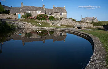
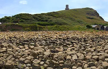
In the Isle of Purbeck
History
Two thousand years in chalk and stone
Purbeck’s history is written into its rock as much as its records, in quarry ledges cut from the cliffs, in a castle built to hold a gap in the hills, and in a coastline important enough to be watched, mined, fortified and, eventually, protected.
c. 8000 BC - AD 43Before Rome
People were working the Purbeck coast from at least the Mesolithic period, and by the Iron Age the peninsula lay within the territory of the Durotriges, the tribe whose hillforts still shape the skyline across this part of Dorset. Flower’s Barrow, above Worbarrow Bay, is one of theirs, and later, confusingly, one of the candidates for Purbeck’s own western boundary.
AD 43 - c. 800Roman shale, Saxon shore
Under Roman occupation, the black shale at Kimmeridge was cut and turned on lathes into jewellery, furniture fittings and decorative panels traded well beyond Dorset, and a Romano-British villa stood at Bucknowle Farm, just below where Corfe Castle would later rise. After Rome withdrew, Anglo-Saxon settlers took the peninsula in turn. Wareham grew into a fortified burh, its earth ramparts still traceable around the town today, and its churches, including the Saxon St Martin’s, are among the oldest in Dorset.
877 - 1645A castle in the gap
A Viking fleet was wreaked off Swanage in 877, and Wareham itself was raided more than once in the Viking Age. But it is Corfe Castle that carries Purbeck’s darkest and most dramatic history. The site is traditionally held to be where the young Saxon king Edward the Martyr was murdered in 978. The Normans built a stone keep there after 1066, one of the earliest castles in England raised in stone rather than timber and earth, commanding the only gap through the Purbeck ridge.
Sir John Bankes bought the castle in 1635; during the Civil War his wife, Lady Mary Bankes, commanded its defence against Parliamentary forces, holding out through a siege in 1643. The castle finally fell in 1645 and was deliberately “slighted”, blown up and demolished, on Parliament’s orders, leaving the broken ruin that still stands over the village today.
Medieval - 19th centuryThe stone that built London
From the medieval period onward, Purbeck’s limestone and marble were quarried on an industrial scale around Swanage, Worth Matravers and Langton Matravers, much of it cut from cliff-face workings such as Tilly Whim, Dancing Ledge, Seacombe and Winspit. Purbeck Marble, which is a polishable fossil limestone rather than a true marble, found its way into the pillars and floors of England’s great cathedrals. Demand for building stone surged again after the Great Fire of London in 1666, and Purbeck and neighbouring Portland stone went on to rebuild much of the capital.
1850s - 1914From quarry town to seaside resort
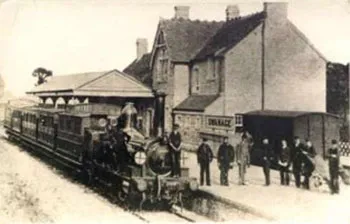
Swanage’s transformation from working stone port to Victorian seaside resort owes much to two men: John Mowlem, the local quarryman’s son who built a London contracting fortune, and his nephew George Burt, who reinvested it in the town, famously shipping surplus London street furniture, facades and monuments back to Swanage by barge. The railway reached the town in 1885 and a pier followed soon after, and Purbeck stone quietly gave way to Purbeck tourism as the peninsula’s main trade.
1914 - 1972War and withdrawal
Both World Wars left their mark on the peninsula. Worth Matravers hosted vital early radar research during the Second World War, and the Ministry of Defence has held training ranges around Worbarrow Bay since 1943, including the village of Tyneham, evacuated in 1943 and never resettled. The railway that had once carried tourists and stone alike closed in 1972, part of a wider post-war decline that Purbeck, like many British seaside areas, took decades to recover.
2001 - todayPurbeck today
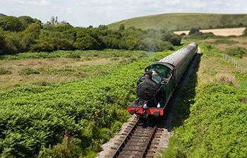
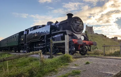
The old Swanage branch line now runs again as a heritage railway, the pier has been restored by trust volunteers, and in 2001 the coastline from Studland to beyond Purbeck was inscribed as part of the Jurassic Coast, England’s only natural World Heritage Site. Purbeck’s own local council was abolished in 2019 and folded into the unitary Dorset Council
Explore Purbeck
Continue the story on Virtual Swanage, the full history timeline, the towns and villages, and the routes that get you out into the landscape.