Swanage Carnival
Eight days in late July and early August, the Carnival showground fills the field with a marquee, arena, food stalls, a craft market, and children's fairground. Fireworks on three evenings light up the bay.

From a 19th-century sand quarry to the beating heart of Swanage's summer, a gifted green space overlooking the bay that now hosts the town's greatest celebrations.
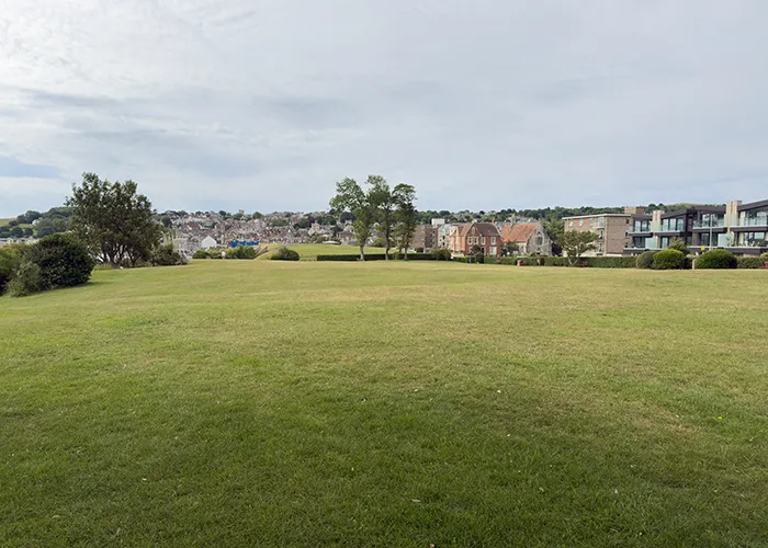
Sandpit Field sits between Shore Road and De Moulham Road, just north of Swanage's Recreation Ground and a short walk from the seafront. It is a broad, open green space with a long and layered history, once an industrial site, today the centrepiece of the town's summer.
The name tells the story. Before the Victorian era transformed Swanage into a seaside resort, this area near the bay was rough grassland and sand dunes, and sand was its most valuable product. According to the Dorset Historic Towns Survey, the early 19th century saw active sand quarrying here, with workers extracting material that was likely used in local construction and building trades. The hollows created by that extraction shaped the ground in ways that are still subtly visible in the landscape today, and they gave the field the name it has carried ever since.
Once sand extraction ended and Swanage began to grow as a holiday destination in the latter half of the 1800s, the area gradually settled into open land. By the early 20th century it had become part of the wider seafront character of the town, bounded on one side by the new Shore Road and backed by the residential streets of the De Moulham Estate.
Today Sandpit Field is one of Swanage's most cherished public assets, an open, accessible green space that welcomes everyone from a family taking a morning stroll along the seafront to thousands of festival-goers gathering for Carnival Week. Its history runs from the industrial to the recreational, from the functional to the celebratory, and its future is the subject of significant investment as the town works to protect this irreplaceable piece of the seafront for the next hundred years.
In the early decades of the 19th century, Swanage was still primarily a working port and stone-trading town. The land to the north of the Recreation Ground was not yet the polished seafront green space it would become. Instead, it was marginal coastal ground, a mix of sand dunes and rough grassland close to the bay, and it was being actively worked. The Dorset Historic Towns Survey identifies an early 19th century sand quarry on this site, part of a broader pattern of coastal resource extraction that was common in small seaside settlements before the age of tourism transformed their economies.
Sand was a valuable building material, essential for lime mortar, plasterwork, and the general construction that was expanding rapidly as Swanage itself began to grow. Workers would have dug into the dune deposits here, carting the material away for use in buildings across the town and possibly for trade with Poole and beyond. The depth and extent of the extraction is not fully documented, but it was significant enough to leave a lasting impression on both the topography of the field and, more permanently, on its name.
Sand and gravel extraction at the coastal edge of Swanage was a natural extension of the town's existing stone trade, which had made the Mowlem family and their partners wealthy. Purbeck's geology offered not only building stone from the quarries of the Isle but also the softer coastal deposits that served the humbler needs of everyday construction. By the time the Victorian tourist trade began to take hold in Swanage in the 1860s and 1870s, the quarrying had ceased and the land was gradually transitioning to a different kind of use.
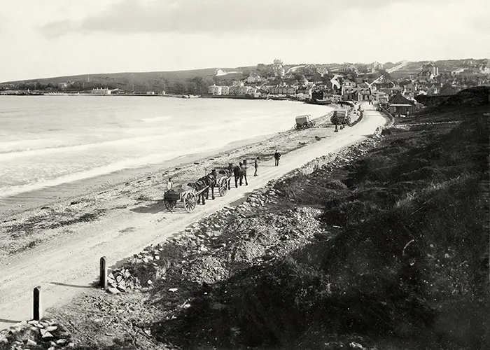
The area had been open dune and rough grassland until the early 1900s, when the expansion of Swanage as a resort began to impose more formal order on the seafront environs. The decisive change came in 1910, when the construction of the southern end of Walrond Road required cutting through the cliff, physically dividing what had been a single stretch of coastal ground into two separate parcels. To the south became the Weather Station Field; to the north, what we now know as Sandpit Field.
This engineering work was part of the broader development of the De Moulham Estate, which was transforming the land behind the beach into residential and recreational use during this period. A decade later, in 1922, further changes to the coastal edge saw the northern section of Shore Road widened by cutting back the bank and building the high retaining walls that still run along the seafront today, walls that now show signs of the subsidence that has become one of the field's most pressing challenges in the 21st century.
Together, these Edwardian engineering works established the physical shape of Sandpit Field as it remains today: a roughly rectangular green space, elevated slightly above Shore Road on its seafront side, with the old retaining walls forming its western boundary and Walrond Road its southern edge. The coastal cliff beneath this raised ground is the source of the erosion and slippage that the town is currently working to address.
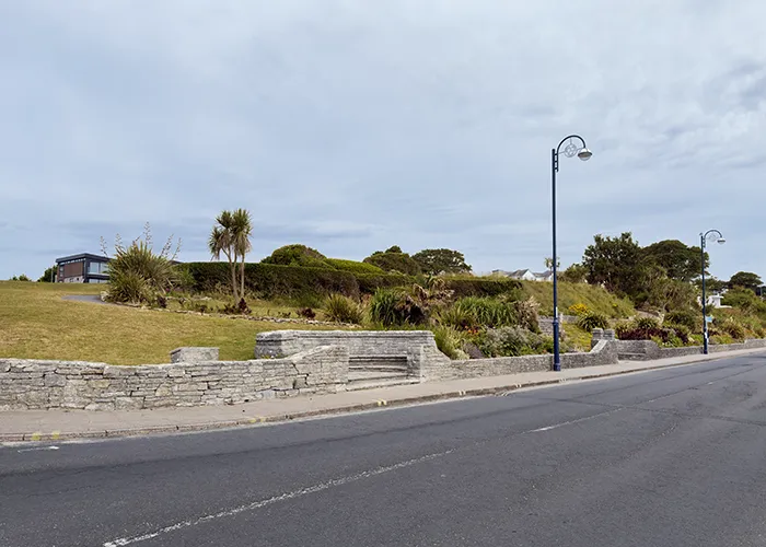
Like so much of Swanage's public green space, Sandpit Field owes its existence as common land to the extraordinary generosity of the Mowlem family, the construction dynasty whose fortunes were built on Purbeck stone and Victorian London's insatiable appetite for paving and masonry. The family's connections to Swanage run through the town like the seams of Purbeck marble run through its geology.
The neighbouring Weather Station Field was given to the town by John Ernest Mowlem in 1924, together with three other small parcels of land, and registered with the Charity Commission as the Gift of Public Pleasure Grounds Charity. Sandpit Field itself came later: it was gifted to the town by the executors of Arthur Rainsford Mowlem in 1990, bringing the whole of the Green Seafront into public ownership. The land, along with covenants on property across the De Moulham Estate, was subsequently registered as a charity in the mid-1990s.
Swanage Town Council holds both fields in its capacity as corporate trustee of the charities, an arrangement that has recently become the subject of a legal process, as the council seeks to transfer the charitable status of the land to enable the investment needed to stabilise the eroding cliff beneath the field. The council has committed to legally binding protections ensuring both fields remain permanent public open space, regardless of the outcome of that process.
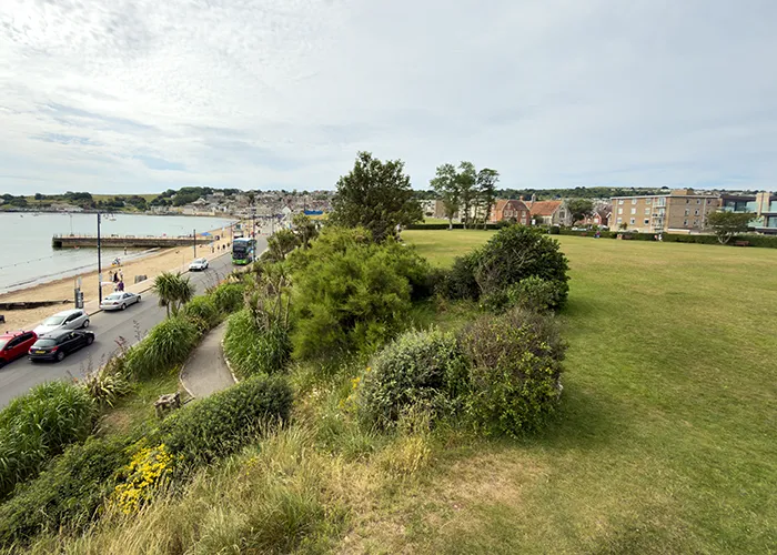
Swanage's position on the Dorset coast made it a strategically important location during the Second World War. Metal poles and wire barriers were embedded in the sand along the beach to repel potential invasion craft; observation posts and gun emplacements were established at Ballard Down and Peveril Point to watch over the bay; and the whole character of the town was altered by the presence of military activity and the threat of aerial attack.
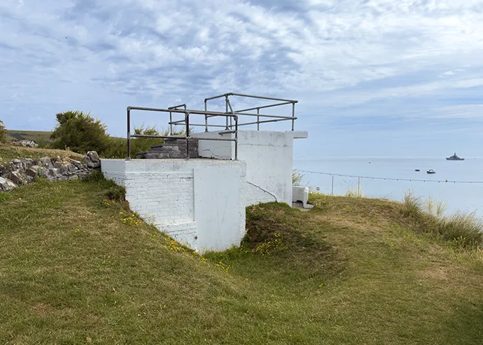
Sandpit Field was not immune to this wartime reshaping. A World War Two lookout, referenced in the Dorset Historic Towns Survey and in the records of the 2023 stabilisation consultation, was constructed on the field, making use of its elevated position above Shore Road to monitor activity in Swanage Bay. The adjacent Sandpit Gardens still retains a surviving WWII gun emplacement, since repurposed as a public shelter, which stands as a tangible reminder of those years.
The wartime lookout on Sandpit Field itself remained a distinctive feature of the landscape for decades after the war ended, long outlasting its original purpose and becoming part of the familiar backdrop of the field. Its future was placed in question by the 2023 coastal stabilisation proposals, which included its removal under the more ambitious redesign option. Whether it survives the eventual stabilisation works will depend on which scheme is ultimately chosen.
Whatever the month between late spring and early autumn, there is a good chance that Sandpit Field will have something going on. The broad flat expanse of the field, its open views towards Swanage Bay, and its position right at the seafront make it the natural home for the town's biggest and most popular events, and the calendar has grown steadily over the years to reflect that.
Swanage Carnival, which traces its origins to a sailing regatta in the 1800s and now runs for eight days in late July and early August, is the largest and most significant. Its showground is anchored in Sandpit Field, with the carnival's marquee, arena, food stalls, beer tent, craft market, and children's fairground all taking over the space for the week. The fireworks displays, let off on the opening Saturday, the Wednesday, and the closing Saturday, are visible from the field itself, which offers one of the best vantage points in town over the bay.
The summer also brings the Swanage Jazz Festival, with Sandpit Field as one of its main venues alongside The Mowlem Theatre; the Swanage Pirate Festival, which transforms the field into a swashbuckling adventure of living history displays, sword fights, and cannon fire; and the Fish and Food Festival, which has grown into a major Dorset foodie event attracting record crowds. The Swanage and Purbeck Rotary Fête also calls the field home each August.

A summer calendar that makes the field one of the busiest outdoor venues on the Dorset coast.
Eight days in late July and early August, the Carnival showground fills the field with a marquee, arena, food stalls, a craft market, and children's fairground. Fireworks on three evenings light up the bay.

Three days in early July, with Sandpit Field as a main outdoor venue alongside The Mowlem Theatre and fringe events in local pubs. Dozens of bands, from trad jazz to contemporary swing.

Two days in late May, sword fights, cannon displays, living history stalls, and a pirate ship in the bay. Sandpit Field becomes the base camp for reenactor groups from across the country.

A weekend in June celebrating Swanage and Purbeck's finest food and drink, lobster, crab, oysters, artisan producers, chef demonstrations, and live music in one of Dorset's favourite foodie events.
Sandpit Field sits on ground that is slowly slipping towards the sea. Engineering surveys commissioned by Swanage Town Council have identified ground movement and slope instability across the Green Seafront, the run of land that takes in Sandpit Field, Weather Station Field and the Spa beach hut terrace, with dozens of defects recorded in retaining walls and slopes. Without major work, there is a real risk of losing parts of these well-used spaces.
To address this, the council has developed the Swanage Green Seafront Stabilisation and Enhancement Scheme. After several years of technical studies and public consultation, the preferred plan is a roughly £6.9 million project that would stabilise the ground and enhance the area, keeping Sandpit Field as the town's main events field with improved accessibility, new planting and better connections to the beach.
In May 2026 Dorset Council agreed to contribute funding towards the scheme, alongside a separate set of improvements to Shore Road, closing the gap in the town council's budget. The next stages of detailed design, planning and procurement are expected to run through 2026 and 2027, with construction currently anticipated to begin in autumn 2027 and the work aimed at completion before the 2028 summer season. As this is a live council project, the details and timings may change, so the Swanage Town Council and Dorset Coast pages are the best place to check the current position.
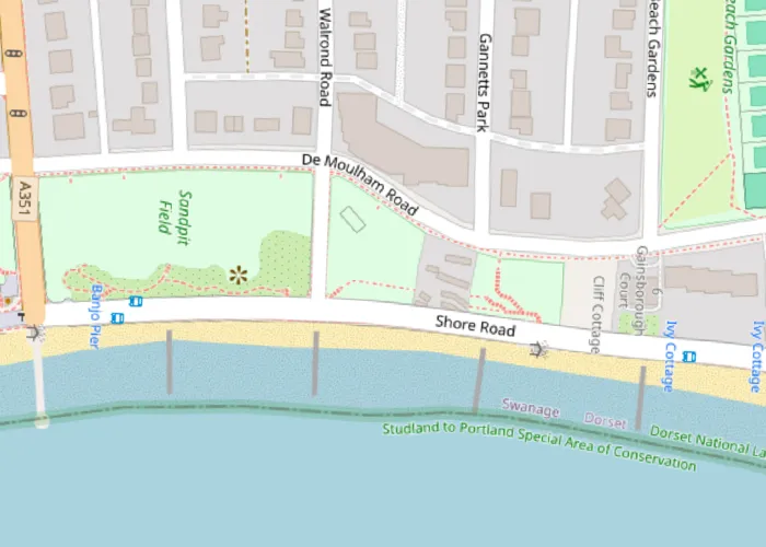
The field is right on the seafront, with the beach, the Recreation Ground, the information centre and the town centre all within a short, level walk. It makes an easy stop on any day out in Swanage, and the obvious base for Carnival week.
The field is the carnival showground. Eight days of processions, fireworks, music and family events.
Enjoy the Carnival
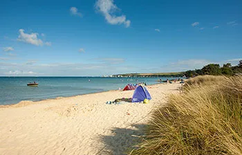
The Blue Flag sandy beach is right below the field, with safe swimming, watersports, and the bay on your doorstep.
Visit the beach
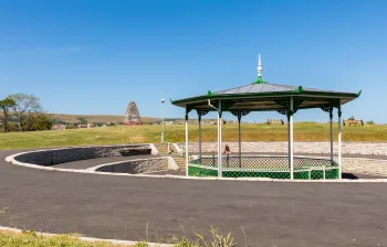
The Rec sits just south of Sandpit Field, 0.1 miles away, with play area, bandstand, and more open space by the sea.
Visit the Recreation Ground
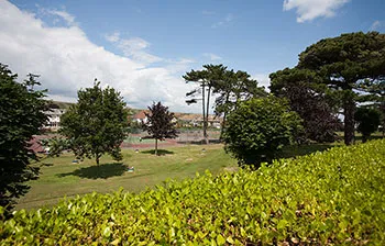
Tennis, bowls, and putting greens a short walk away, 0.2 miles from the field.
Visit Beach Gardens
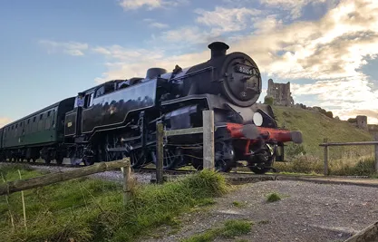
The heritage steam railway is 0.2 miles away. The Norden Park and Ride is the easiest way into town on busy days.
Visit Swanage Railway

The Swanage Information Centre, 0.1 miles away, is one of the longest serving visitor centres in the UK.
Tourist information
The Dorset Historic Towns Survey, produced for Dorset Council in 2011, identifies Sandpit Field as the site of an early 19th century sand quarry. The survey notes that the coastal location of this part of Swanage makes significant archaeology unlikely, but that the area would have been used for marginal activities including fishing and sand and gravel extraction, and that the sand quarry here is the archaeological feature of particular note.
The exact dates and extent of the extraction are not recorded in surviving documents, but the quarrying was evidently substantial enough to be documented on early maps and surveys of the town, and to give the field the name it still carries nearly two hundred years later. The hollowed-out character of early 19th-century Swanage's seafront fringe, shaped partly by this extraction, was gradually smoothed over by later development, but the name, and the story it tells, remain.
It is a reminder that Swanage's relationship with the materials of the Purbeck landscape was never confined to stone alone. Sand, gravel, and the soft coastal deposits of the bay were part of the local economy long before tourism became the town's dominant industry, and Sandpit Field is one of the few places in Swanage where that earlier, less celebrated history survives in the landscape itself, preserved in a name.
Sources used to verify and expand the information on this page: