St Aldhelms Head Walk
3miles
Length
120metres
Elevation gain
21minutes
Average time
Road
Ride Type
This is a 3 mile walk starting near Worth Matravers, exploring the coast path above Chapmans Pool to St Aldhelms Head with views along the Jurassic Coast to Portland in the distance. The outgoing route is mostly on grassy footpaths and the return section is on a route gravel track
Start: Car park at grid ref SY 96423 77415 near Worth Matravers
These routes have been recorded using a Garmin GPS unit. We cannot guarantee the accuracy of the available data files due to differences between GPS devices.
Route
Start in the Car Park
Elevation: 115 metres
OS Grid Reference: SY 96426 77418
Lat, long: 50.59648, -2.05186
Start in the car park at grid ref SY 96423 77415 near Worth Matravers
Exit the car park
Elevation: 115 metres
OS Grid Reference: SY 96421 77387
Lat, long: 50.59620, -2.05193
At the South end of the car park, go though a wood stile and head South West across a open field to the next stile
Stile and field
Elevation: 117 metres
OS Grid Reference: SY 96108 77261
Lat, long: 50.59506, -2.05635
Go straight ahead at the stile and continue across the open field to a stone wall and stile.
Stile and Wall
Elevation: 113 metres
OS Grid Reference: SY 95979 77237
Lat, long: 50.59484, -2.05816
Go over the stile and turn left following the foot path along the side of the fence / wall
Stile
Elevation: 109 metres
OS Grid Reference: SY 95889 76808
Lat, long: 50.59098, -2.05944
Continue over the stile and continue along the narrow path. take care as there is a long drop on the right side of this path.
Steps
Elevation: 97 metres
OS Grid Reference: SY 95931 76087
Lat, long: 50.58451, -2.05883
Follow the steps down into the valley and up the other side and continue along the narrow path to the Coastguard building.
Coastguard Building and St Aldhelms Head
Elevation: 93 metres
OS Grid Reference: SY 96067 75505
Lat, long: 50.57927, -2.05691
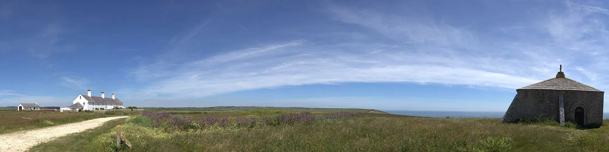
At the Coastguard building turn left onto a wide stone track and continue North East past the stone church building
Junction with Cottages entrance
Elevation: 103 metres
OS Grid Reference: SY 96061 75614
Lat, long: 50.58025, -2.05699
Turn right and follow the stone track back to the car park and start of the walk
Elevation Chart and Map
Move your mouse over the elevation line to view the location on the route map.
Walker & Cyclist Friendly Accommodation
Whether you’re exploring scenic trails, tackling longer routes, or simply enjoying a leisurely ride, choosing the right base makes all the difference. Below you’ll find details of some of the many local accommodation businesses that understands the needs of outdoor enthusiasts, helping you relax, recharge, and get ready for your next journey.