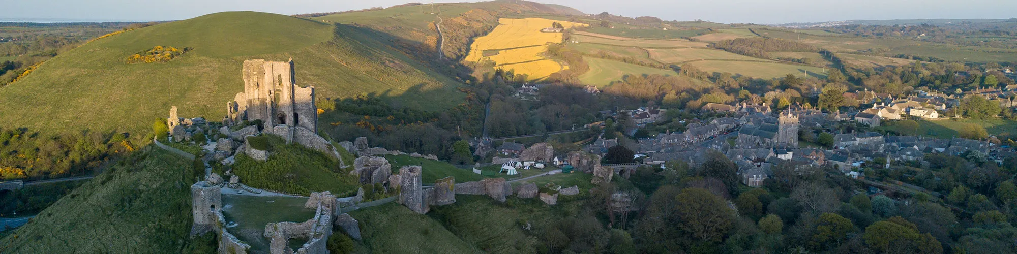
Purbeck Hills and Woodland Ride
16miles
Length
350metres
Elevation gain
2hours 17minutes
Average time
Off Road
Ride Type
This off-road route starts in Swanage and loops through the Purbeck Hills, passing Old Harry Rocks before heading into a short but engaging single-track woodland section near Harmans Cross. Riders will experience a varied ride with challenging climbs, rewarding descents, open heathland, dense woodland, and dramatic coastal views, all within a roughly 16-mile loop.
Start:
Main Beach Car Park
Victoria Avenue
Swanage
BH19 1PW
OS Grid Ref: SZ 02667 79104
These routes have been recorded using a Garmin GPS unit. We cannot guarantee the accuracy of the available data files due to differences between GPS devices.
Route
Start of ride
Elevation: 9 metres
OS Grid Reference: SZ 02745 79104
Lat, long: 50.61164, -1.96257
Start from the Car park in Victoria Avenue, exit the car park and turn right onto Victoria Avenue and then left onto Northbrook Road.
Roundabout
Elevation: 30 metres
OS Grid Reference: SZ 02462 80266
Lat, long: 50.62210, -1.96656
Roundabout, Turn right at the mini roundabout.
Cross Roads
Elevation: 27 metres
OS Grid Reference: SZ 02664 80351
Lat, long: 50.62286, -1.96370
Cross the main road and follow road up to rough track and left following bridleway sign up hill.
Bridleway
Elevation: 55 metres
OS Grid Reference: SZ 02877 80767
Lat, long: 50.62660, -1.96068
Follow very steep track up the side of the hill through trees and then up chalk path.
Top of the hill
Elevation: 137 metres
OS Grid Reference: SZ 03348 81282
Lat, long: 50.63123, -1.95403
Turn right at the top of the hill next to the wooden sign and follow track east past through wooden gates and follow track down towards Old Harry / The Foreland.
The Foreland
Elevation: 24 metres
OS Grid Reference: SZ 05436 82535
Lat, long: 50.64248, -1.92448
Turn left at The Foreland and follow wide track back to Studland village.
Studland Village
Elevation: 12 metres
OS Grid Reference: SZ 03903 82438
Lat, long: 50.64162, -1.94617
At the junction next to the public toilets, turn right and follow the road up the hill past the pub and then turn left at the next junction
Main Road Junction
Elevation: 30 metres
OS Grid Reference: SZ 03459 82589
Lat, long: 50.64298, -1.95244
Turn right onto the B3351 and follow the road down though the village until you come to a bridleway sign on the left side of the road. The bridleway is before you reach Knowle House Hotel.
Bridleway
Elevation: 21 metres
OS Grid Reference: SZ 03224 83159
Lat, long: 50.64810, -1.95576
Turn left through a wooden gate and follow the bridleway across the field until you come to a wide track.
Track junction
Elevation: 27 metres
OS Grid Reference: SZ 03070 82986
Lat, long: 50.64655, -1.95794
Turn right and follow the track down into wooded area, through a gate and over a small wooden bridge at the stream, Go across the bridge and turn left and follow the bridleway across the heathland going straight ahead at the junctions until you come to an open field with a wooden sign post
Sign Post
Elevation: 21 metres
OS Grid Reference: SZ 01823 83827
Lat, long: 50.65412, -1.97557
When the track opens to a wide field with a wooden signpost, bear right and continue across the field to the fence line and a gate.
Gate and Junction
Elevation: 10 metres
OS Grid Reference: SZ 01588 84185
Lat, long: 50.65734, -1.97890
Go though the gate and turn left and continue through the next gate and across a small stream. Turn right onto a wide forest track and continue along the track until you come to a cross roads then turn right and continue along the track until you come to a gate and tarmac road
Cross roads
Elevation: 23 metres
OS Grid Reference: SZ 00140 84473
Lat, long: 50.65993, -1.99938
At the gate turn left and follow the tarmac road until you come to a T junction with a off road track straight ahead.
Junction and Stop Sign
Elevation: 18 metres
OS Grid Reference: SY 99417 84043
Lat, long: 50.65606, -2.00961
At the junction continue straight ahead and follow the rough track until you come to a tarmac road.
Junction with road
Elevation: 21 metres
OS Grid Reference: SY 97689 83533
Lat, long: 50.65147, -2.03406
Turn left at the junction onto the tarmac road and continue straight ahead at the next junction and continue up the road until you come to a T junction with the B3351
T Junction
Elevation: 31 metres
OS Grid Reference: SY 97222 82766
Lat, long: 50.64457, -2.04065
Turn right onto the B3351 and continue until you come to a bridleway sign on the left at Rollington Farm
Rollington Farm Junction
Elevation: 33 metres
OS Grid Reference: SY 96890 82842
Lat, long: 50.64525, -2.04534
Turn left at the farm junction and follow the track past the farm buildings, through a metal gate and follow the track up the side of the Purbeck Hills until you come to the transmitter site and a metal gate on the left side.
Transmitter Gate
Elevation: 102 metres
OS Grid Reference: SY 97265 82126
Lat, long: 50.63882, -2.04004
Go through the gate and bear right and follow the wide chalk track down the side of the hill until you come to a junction and gate
Lower track
Elevation: 90 metres
OS Grid Reference: SY 97444 81996
Lat, long: 50.63765, -2.03750
Bear left and follow the narrow bridleway along the side of the hill
Gate
Elevation: 104 metres
OS Grid Reference: SY 97703 81950
Lat, long: 50.63724, -2.03385
Continue straight ahead at the gate
Gate
Elevation: 115 metres
OS Grid Reference: SY 98018 81881
Lat, long: 50.63661, -2.02938
Continue straight ahead at the gate
Gate and Junction
Elevation: 133 metres
OS Grid Reference: SY 98545 81720
Lat, long: 50.63518, -2.02193
When the track joins a wider chalk track from the top of the hill turn right and go through the gate and follow the wide track down to the tarmac road.
Road
Elevation: 103 metres
OS Grid Reference: SY 98534 81443
Lat, long: 50.63268, -2.02209
Turn left onto the tarmac road and continue a short distance until you come to a T junction
T junction
Elevation: 105 metres
OS Grid Reference: SY 98603 81414
Lat, long: 50.63242, -2.02111
Turn right at the T junction and follow the narrow road down the side of the valley and up a small hill to a cross roads at Harmans Cross
Cross Roads
Elevation: 71 metres
OS Grid Reference: SY 98429 80370
Lat, long: 50.62304, -2.02357
At the cross roads, continue straight ahead and follow the road down the hill to the railway bridge and continue up the hill until you come to a rough track on your left with a bridleway sign.
Bridleway junction
Elevation: 83 metres
OS Grid Reference: SY 98465 79495
Lat, long: 50.61516, -2.02306
Turn left and follow the wide track until you come to the entrance to a field and bridleway sign on your left, left and follow the narrow bridleway track down the hill turning right into a open field and then left down the edge of the field until you come to a metal gate.
Metal Gate
Elevation: 62 metres
OS Grid Reference: SY 98701 79550
Lat, long: 50.61566, -2.01972
Go through the metal gate and turn right following a track across the field towards the farm buildings and a metal gate. Go through the metal gate and follow the bridleway signs along the edge of the farm buildings and left at the end of the barn to a metal gate going into the woodland area.
Metal Gate
Elevation: 59 metres
OS Grid Reference: SY 98998 79675
Lat, long: 50.61679, -2.01552
Go through the metal gate and follow the singletrack through the woods until you come to a rough track junction
Rough Track
Elevation: 48 metres
OS Grid Reference: SY 99570 79669
Lat, long: 50.61673, -2.00744
Turn left onto the track and follow the unmade road until you come to a cross roads with the A351
A351 Cross roads
Elevation: 31 metres
OS Grid Reference: SY 99923 79625
Lat, long: 50.61634, -2.00244
Turn right onto the A351 and follow the road back to Swanage and continue along the High Street, onto Victoria Avenue and back to the start at the car park.
Elevation Chart and Map
Move your mouse over the elevation line to view the location on the route map.
Walker & Cyclist Friendly Accommodation
Whether you’re exploring scenic trails, tackling longer routes, or simply enjoying a leisurely ride, choosing the right base makes all the difference. Below you’ll find details of some of the many local accommodation businesses that understands the needs of outdoor enthusiasts, helping you relax, recharge, and get ready for your next journey.