Hills and Heathland
15.5miles
Length
665metres
Elevation gain
2hours 30minutes
Average time
Off Road
Ride Type
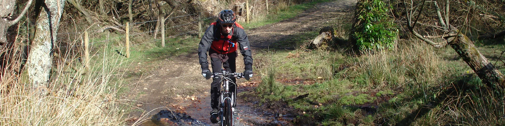
This 15.5-mile cycling route begins in Swanage and follows the ridge of the Purbeck Hills, giving riders some of the most spectacular views in Dorset. The route passes the dramatic landmark of Old Harry Rocks, where the chalk cliffs plunge into the sea, before looping back through the wide open spaces of Studland Heath and skirting the edge of Rempstone Forest.
From the top of the Purbeck Hills, the scenery is truly breathtaking, with panoramic views stretching across the Isle of Purbeck, over Poole Harbour, and on a clear day as far as the Isle of Wight. The mixture of open heathland, forest trails and coastal vistas makes this a wonderfully varied ride.
Although not the toughest of the Purbeck routes, the undulating terrain provides a good workout with some steady climbs, rewarding you with unforgettable views and a real sense of achievement.
Start:
Main Beach Car Park
Victoria Avenue
Swanage
BH19 1PW
OS Grid Ref: SZ 02667 79104
These routes have been recorded using a Garmin GPS unit. We cannot guarantee the accuracy of the available data files due to differences between GPS devices.
Route
Start of Ride
Elevation: 4 metres
OS Grid Reference: SZ 02727 79105
Lat, long: 50.61165, -1.96282
Start from the Car park in Victoria Avenue, exit the car park and turn right onto Victoria Avenue and then left onto Northbrook Road.Continue along Northbrook Road until you come to a mini roundabout and go straight ahead past the road junction on your left, until you come to a T Junction onto Ulwell Road.
Ulwell Road and Darkie Lane
Elevation: 45 metres
OS Grid Reference: SZ 02231 80818
Lat, long: 50.62706, -1.96981
Turn left ontoUlwell Road and follow the signs for Studland. The road bears right after the next Y Junction and up the hill. Turn right at the bridleway sign/junction on the right side.
Bridleway Junction
OS Grid Reference: SZ 02019 81632
Lat, long: 50.63438, -1.97282
Turn right on to the bridleway and go though the metal gate and follow the rough track up the hill to the stone Obelisk.
Obelisk
OS Grid Reference: SZ 02228 81305
Lat, long: 50.63144, -1.96987
At the stone Obelisk, continue straight ahead and follow the track up the hill to a gate. Go straight ahead at the gate and follow the track east past through two wooden gates and down towards Old Harry / The Foreland.
The Foreland
OS Grid Reference: SZ 05419 82465
Lat, long: 50.64185, -1.92472
Turn left at The Foreland and follow wide track back to Studland village.
Road and Public Toilets
OS Grid Reference: SZ 03865 82422
Lat, long: 50.64148, -1.94670
At the village go straight ahead at junction and follow the road up hill and to the right to the village shop and cross roads.
Cross Roads
OS Grid Reference: SZ 03443 82477
Lat, long: 50.64197, -1.95267
At the cross roads go straight ahead.
Bridleway Junction
OS Grid Reference: SZ 03220 82436
Lat, long: 50.64161, -1.95582
Turn right into rough track and follow bridleway until the track forks left and right with a gate on the left side.
Track Junction
OS Grid Reference: SZ 03013 82884
Lat, long: 50.64564, -1.95874
Turn left and follow bridleway up across the heathland going though several gates, until you come to the open area with the golf course at the top of the hill.
Junction
Elevation: 106 metres
OS Grid Reference: SZ 01784 82023
Lat, long: 50.63789, -1.97613
Turn right at the junction at the top of the golf course track and follow the bridleway signs to Agglestone Rock with the golf course on your right side.
Bridleway junction
OS Grid Reference: SZ 01865 82186
Lat, long: 50.63936, -1.97499
Turn left into a narrow sandy track and follow the track down to double wooden gates. Go straight ahead at the gates and follow the track down hill to a bridleway sign on the left before the path narrows and changes to a footpath at Agglestone Rock
Bridleway Junction
OS Grid Reference: SZ 02320 82741
Lat, long: 50.64435, -1.96854
Turn left and follow the track
Bridleway Junction
OS Grid Reference: SZ 02116 82786
Lat, long: 50.64476, -1.97143
Turn right at the Y junction on the track
Bridleway Junction
OS Grid Reference: SZ 02070 82819
Lat, long: 50.64505, -1.97208
Turn right at the Y junction on the track and follow the wide track down across the heathland.
Bridleway Cross Roads
OS Grid Reference: SZ 02449 83271
Lat, long: 50.64912, -1.96672
At a cross roads with a second track, continue straight ahead and follow the wide track until you come to a gate and the ferry road.
Ferry Road and Gate
OS Grid Reference: SZ 02536 84347
Lat, long: 50.65880, -1.96548
At the ferry road, go through the gate and turn left and follow an unmade rough track down towards the forest.
Gate and Junction
OS Grid Reference: SZ 01836 84502
Lat, long: 50.66019, -1.97538
Then the track splits to the right with a gate ahead, continue straight ahead though the gate and across an open field until you come to a gate and a small stream.
Gate and stream
OS Grid Reference: SZ 01547 84198
Lat, long: 50.65745, -1.97947
Go through the gate and down a small slope to a stream with a wooden bridge. You can either cross the water on the bridge or ride through the water. Go up the small slope and then turn left and follow a wide forest track along the edge of the trees until you come to a large metal tank on the left side with Franks Tank written on the side.
Franks tank
OS Grid Reference: SZ 00449 82848
Lat, long: 50.64531, -1.99501
Go though the wooden gate on the left side and follow the bridleway signs up across the heathland along the edge of the golf course.
Bridleway Junction
OS Grid Reference: SZ 01783 82105
Lat, long: 50.63863, -1.97615
At a T junction turn right and follow the outgoing track straight ahead and up to the road.
Gate and Road Junction
OS Grid Reference: SZ 01708 81879
Lat, long: 50.63660, -1.97721
Turn right onto the B3351.
T Junction
OS Grid Reference: SZ 01248 81793
Lat, long: 50.63583, -1.98371
Turn left at the T junction and follow the road down the hill.
Y Junction
OS Grid Reference: SZ 01812 81222
Lat, long: 50.63070, -1.97574
At next junction, turn right onto the main road back to Swanage and continue along Ulwell Road and along the sea front.
Victoria Avenue (A351) and Shore Road
OS Grid Reference: SZ 03073 79141
Lat, long: 50.61198, -1.95793
Turn right onto Victoria Avenue and follow the road back to the car park and start of the ride.
Elevation Chart and Map
Move your mouse over the elevation line to view the location on the route map.
Walker & Cyclist Friendly Accommodation
Whether you’re exploring scenic trails, tackling longer routes, or simply enjoying a leisurely ride, choosing the right base makes all the difference. Below you’ll find details of some of the many local accommodation businesses that understands the needs of outdoor enthusiasts, helping you relax, recharge, and get ready for your next journey.