Kilwood Nature Reserve Walk
2.5miles
Length
200metres
Elevation gain
22minutes
Average time
Walk
Ride Type
This is a hilly 2.5 mile walk exploring the north side of the Purbeck hills between Norden and Creech including the Kilwood Nature Reserve.
Start: Start at a metal gate sign posted Kilwood Nature Reserve at OSGB36 Grid ref: SY 9329582476 on Furzebrook Road. Limited parking spaces are on the side of the road.
These routes have been recorded using a Garmin GPS unit. We cannot guarantee the accuracy of the available data files due to differences between GPS devices.
Route
Start
Elevation: 71 metres
OS Grid Reference: SY 93295 82476
Lat, long: 50.64194, -2.09618
Start at a metal gate sign posted Kilwood Nature Reserve at OSGB36 Grid ref: SY 9329582476 on Furzebrook Road. Limited parking spaces are on the side of the road. Go though the gap next to the metal gate and go across the field to a fence and wooden stile.
Stile and start of hill climb
Elevation: 74 metres
OS Grid Reference: SY 93388 82414
Lat, long: 50.64137, -2.09487
Go over the stile and follow a very steep and narrow track up the hill heading to the left. This maybe slippery in winter or after rain. Follow the narrow path up the hill to the next stile.
Stile
Elevation: 132 metres
OS Grid Reference: SY 93621 82296
Lat, long: 50.64032, -2.09158
Go over the wooden stile and follow the path to the top of the hill and a stone marker post.
Stone marker post
Elevation: 139 metres
OS Grid Reference: SY 93647 82257
Lat, long: 50.63997, -2.09120
At the top of the hill and stone post, turn left and follow the ridge path heading east towards Corfe Castle. At the first gate continue straight ahead until you come to the second gate on the upper path.
Gate
Elevation: 130 metres
OS Grid Reference: SY 94319 82321
Lat, long: 50.64055, -2.08170
Go through the gate and walk left at approx 45 degrees until you come to the fence line. Continue along this fence until you come to a wooden stile on your left.
Wooden Stile
Elevation: 129 metres
OS Grid Reference: SY 94531 82392
Lat, long: 50.64119, -2.07871
Go over the stile and continue at a 45 deg angle down the hill to your right until you come to a track heading down the hill to your left.
Hillside Track
Elevation: 113 metres
OS Grid Reference: SY 94648 82433
Lat, long: 50.64156, -2.07704
At the track, turn left and follow the narrow stone and gravel track down the hill heading North-West until you come to a fence line and a wooden swing gate.
Wood Gate
Elevation: 74 metres
OS Grid Reference: SY 94480 82564
Lat, long: 50.64273, -2.07944
Go through the wooden swing gate and continue North down across an open field.
Wood Gate
Elevation: 51 metres
OS Grid Reference: SY 94462 82654
Lat, long: 50.64355, -2.07968
Go through the wooden swing gate and continue North following the path.
Wood Gate
Elevation: 44 metres
OS Grid Reference: SY 94452 82711
Lat, long: 50.64406, -2.07983
Go through the wooden swing gate and continue North following the path until you come to the end of the field and another wood swing gate.
Wood Gate and Bridleway
Elevation: 45 metres
OS Grid Reference: SY 94436 82859
Lat, long: 50.64539, -2.08005
Go though the gate and turn left, following the bridleway track until you come to a wooden bridge with a small lake on your left side.
Wood Bridge and footpath junction
Elevation: 50 metres
OS Grid Reference: SY 93941 82837
Lat, long: 50.64518, -2.08706
Turn left after the bridge and follow the bridleway heading west until you come to a junction with a wide wood gate and narrow wood swing gate on your right.
Wide gate and Wood swing gate
Elevation: 54 metres
OS Grid Reference: SY 93795 82878
Lat, long: 50.64556, -2.08912
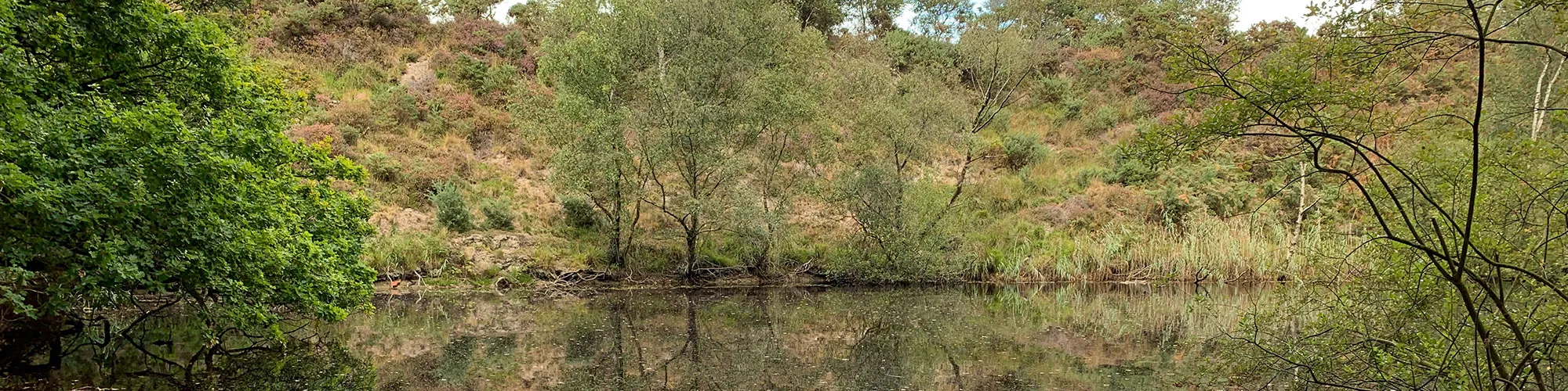
This section is optional as you can continue straight along the bridleway to step 15. This small detor takes you around one of the many small lakes and ponds in the area from historic clay mining. Go though the gate and follow a narrow path up a small hill which overlooks the lake. Follow the very narrow path around the edge of the lake until you come to a T junction in the track.
T Junction
Elevation: 56 metres
OS Grid Reference: SY 93672 83007
Lat, long: 50.64672, -2.09086
At the T junction in the narrow paths, turn left and continue following the very narrow path around the edge of the lake down a steep hill to the waters edge then heading right and up a narrow path which returns you to the bridleway.
Wooden Gate and bridleway
Elevation: 63 metres
OS Grid Reference: SY 93614 82870
Lat, long: 50.64548, -2.09168
Go though the wooden gate and turn right back onto the main bridleway track
Road junction
Elevation: 73 metres
OS Grid Reference: SY 93282 82850
Lat, long: 50.64529, -2.09638
At the junction with the Furzebrook Road, turn left and follow the road back to the start. Take care as this road can be busy in summer months.
Elevation Chart and Map
Move your mouse over the elevation line to view the location on the route map.
Walker & Cyclist Friendly Accommodation
Whether you’re exploring scenic trails, tackling longer routes, or simply enjoying a leisurely ride, choosing the right base makes all the difference. Below you’ll find details of some of the many local accommodation businesses that understands the needs of outdoor enthusiasts, helping you relax, recharge, and get ready for your next journey.