Purbeck 50 Road Ride
50miles
Length
950metres
Elevation gain
4hours 58minutes
Average time
Road
Ride Type
This 50-mile road ride offers a full circuit of the Isle of Purbeck, starting and finishing in Swanage. The route begins with a steady climb towards Corfe Castle, where the ruins of the medieval fortress dominate the village and surrounding countryside. From here, the ride continues over the crest of the Purbeck Hills before heading north-west towards the quiet lanes around Moreton.
The return journey takes you through a varied mix of rural villages and historic towns before looping back past Corfe Castle for a second time. The ride then continues through Kingston and Langton Matravers, both perched high on the ridge, before descending back into Swanage.
Where possible, the route follows country lanes and quieter back roads, avoiding the busier main routes. One of the highlights is the section across the Lulworth Army Ranges, which are usually open to the public at weekends and during school holidays. This area provides dramatic views of the Jurassic Coast and a chance to experience one of the most unspoilt parts of Dorset.
At 50 miles, this is a demanding ride best suited to experienced cyclists, but the combination of challenging climbs, peaceful country roads, and outstanding scenery makes it a memorable way to explore the Isle of Purbeck.
Start:
Main Beach Car Park
Victoria Avenue
Swanage
BH19 1PW
OS Grid Ref: SZ 02667 79104
These routes have been recorded using a Garmin GPS unit. We cannot guarantee the accuracy of the available data files due to differences between GPS devices.
Route
Start
OS Grid Reference: SZ 02659 79088
Lat, long: 50.61150, -1.96378
Start at the car park in Victoria Avenue, exit the car park and turn right on to Victora Avenue
Northbrook Road Junction
OS Grid Reference: SZ 02750 79108
Lat, long: 50.61168, -1.96250
Turn left onto Northbrook Road and continue up the hill until you come to a mini roundabout
Roundabout
OS Grid Reference: SZ 02455 80295
Lat, long: 50.62236, -1.96665
At the mini roundabout continue straight ahead along Darkie Lane
Ulwell Road and Darkie Lane
OS Grid Reference: SZ 02230 80818
Lat, long: 50.62706, -1.96984
Turn Left onto Ulwell Road and continue along the road until the Y junction
Y Junction
OS Grid Reference: SZ 01812 81219
Lat, long: 50.63066, -1.97574
Turn left at the junction and continue along the road and up steep hill until the T junction
B3351 T Junction
OS Grid Reference: SZ 01240 81794
Lat, long: 50.63584, -1.98383
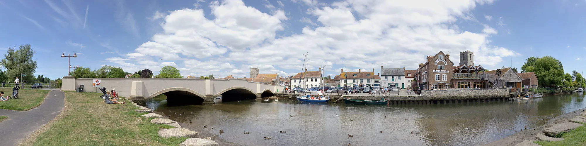
At the T junction with the B3351 turn left and follow the road until you come to a T junction at Corfe Castle
A351 and B3351 Junction
OS Grid Reference: SY 95993 82408
Lat, long: 50.64135, -2.05803
Turn right onto the A351 and then left at the next junction. Caution this is a very busy road at weekends and in the summer
A351 Junction
OS Grid Reference: SY 95958 82430
Lat, long: 50.64154, -2.05852
Junction to Church Knowle - Turn left at the junction signposted to Church Knowle, Steeple and Kimmeridge and follow the road heading west through the village of Church Knowle and continue along the road until it bears right and up a steep hill to a Y junction at the top of the hill.
Grange Hill Y junction
OS Grid Reference: SY 90104 81676
Lat, long: 50.63470, -2.14129
Grange Hill Junction - At the top of Grange Hill turn left at the junction and follow the road across the top of the army ranges across the ridge line and down to a T junction. Please note that the range roads are only open at weekends and school holidays. There is a car park at the highest point which is a idea place for a break to take photos.
B3070 and Army By-Pass Junction
OS Grid Reference: SY 85668 81816
Lat, long: 50.63586, -2.20402
At the junction continue straight ahead
B3070 and B3071 Junction
OS Grid Reference: SY 83511 81593
Lat, long: 50.63380, -2.23452
Turn left and continue down the hill to a T junction
West Road Junction
OS Grid Reference: SY 82533 80725
Lat, long: 50.62596, -2.24830
Turn Right onto West Road and continue along the road until the junction with Church Road
Church Road junction
OS Grid Reference: SY 82241 80805
Lat, long: 50.62668, -2.25243
Turn right onto Church Road and continue along the road until you come to a sharp right corner with a junction on the left. There is a church and graveyard just before this junction.
Junction to East Chaldon Road
OS Grid Reference: SY 80513 84422
Lat, long: 50.65914, -2.27705
Turn left onto East Chaldon Road and follow the road through a small village. There is a pub called the Sailors Return which is a good place for a drink and food stop. Continue along this road over a steep hill climb and down to the cross roads junction with the A352
Wareham Road (A352) and A352 cross road
OS Grid Reference: SY 78709 84868
Lat, long: 50.66309, -2.30260
At the cross roads continue straight ahead on the road with a sign for Tadnoll 1 1/4. Take care at this crossing as the A352 is very busy. Follow Redbridge Road until you come to a T junction with a bridge on the right side.
Redbridge Road Junction
OS Grid Reference: SY 78764 88447
Lat, long: 50.69527, -2.30202
Turn right at the junction and go over the bridge and follow the road until you come to a Y junction with Station Road
Y Junction
OS Grid Reference: SY 79947 89284
Lat, long: 50.70285, -2.28533
Turn left at the junction and continue along the road until you come to a Y junction on your right with a small sign on the left for Village Hall.
Y Junction
OS Grid Reference: SY 79632 89317
Lat, long: 50.70313, -2.28979
Turn Right at the Y junction and follow the narrow road until the junction with the B3390
B3390 Junction
OS Grid Reference: SY 79109 90058
Lat, long: 50.70978, -2.29724
Turn right onto the B3390 and follow the road until you come to a cross roads with a sign for Wareham on the right side
B3390 Cross Roads
OS Grid Reference: SY 79948 91074
Lat, long: 50.71894, -2.28541
Turn right at the cross roads and follow the road until you come to a T junction with a sign for Bere Regis 3 and Picnic Area.
T Junction
OS Grid Reference: SY 84344 90596
Lat, long: 50.71478, -2.22312
Turn Left at the junction
Lane End Junction
OS Grid Reference: SY 84594 92802
Lat, long: 50.73463, -2.21967
At the T junction with a sign for Lane End, turn right and follow the road until you come to a T junction with Sugar Hill and Stop signs on the junction.
Sugar Hill Junction
OS Grid Reference: SY 86754 93665
Lat, long: 50.74244, -2.18909
Turn right at the junction and follow the road going though Wareham Forest until you come to a roundabout
Roundabout
OS Grid Reference: SY 91997 88240
Lat, long: 50.69375, -2.11468
At the roundabout continue straight ahead and walk across the railway crossing and then continue straight ahead until you come to a second roundabout.
A351 Roundabout
OS Grid Reference: SY 92079 87926
Lat, long: 50.69093, -2.11351
At the roundabout continue straight ahead into the town of Wareham. Caution, this roundabout is very busy so take care. There is an alternative walkway and cycleway route under the road on the right side approx 100m before the roundabout. Follow the road though Wareham and over the causeway until you come the village of Stoborough and a T junction on the left side onto Nutcrack Lane
South Causeway and Nutcrack Lane Junction
OS Grid Reference: SY 92362 86393
Lat, long: 50.67714, -2.10946
Turn left at the junction with Nutcrack Lane and follow the narrow road heading East past the houses at Ridge until you come to a Y junction with sign for Arne and Corfe Castle
Arne Road Junction
OS Grid Reference: SY 95488 86527
Lat, long: 50.67839, -2.06522
Turn right at junction and follow road across the heathland over 2 cattle grids until you come to a T junction just past the railway bridge.
T Junction
OS Grid Reference: SY 95487 82871
Lat, long: 50.64550, -2.06519
Turn right at junction and then left at roundabout following the A351 towards Corfe Castle and continue though the village until you come to a Y junction on your right with a sign for Langton Matravers and Kingston
Kingston Hill and East Street Junction
OS Grid Reference: SY 96447 81098
Lat, long: 50.62957, -2.05159
Turn right at the junction and follow the steep hill up to Kingston Village
Kingston Village
OS Grid Reference: SY 95719 79627
Lat, long: 50.61634, -2.06187
Follow the road as it turns left at the village and continue along the road and down though the village of Langton Matravers (take care as narrow road with people crossing between parked cars) until you reach the Y junction with Valley Road.
Valley Road Junction
OS Grid Reference: SZ 00759 78856
Lat, long: 50.60942, -1.99064
Turn right onto Valley Road and follow the road into Swanage until the road goes left at the Y junction with the High Street.
High Street Junction
OS Grid Reference: SZ 01716 79006
Lat, long: 50.61076, -1.97710
Turn right onto the High Street and continue along the road.
Court Road Cross Road
OS Grid Reference: SZ 02503 78858
Lat, long: 50.60943, -1.96598
At the cross road at the bottom of Court Road, continue straight ahead and follow the narrow road along side the railway until you come to a T junction with a stone bridge on your left.
Court Road and Northbrook Road Junction
OS Grid Reference: SZ 02682 78897
Lat, long: 50.60979, -1.96346
At the T junction turn left over the bridge and follow the road down to the junction with Victoria Avenue. Turn left and follow Victoria Avenue back to the start.
Elevation Chart and Map
Move your mouse over the elevation line to view the location on the route map.
Walker & Cyclist Friendly Accommodation
Whether you’re exploring scenic trails, tackling longer routes, or simply enjoying a leisurely ride, choosing the right base makes all the difference. Below you’ll find details of some of the many local accommodation businesses that understands the needs of outdoor enthusiasts, helping you relax, recharge, and get ready for your next journey.