Encombe, Creech, Corfe Loop
12miles
Length
425metres
Elevation gain
1hour 51minutes
Average time
Off Road
Ride Type
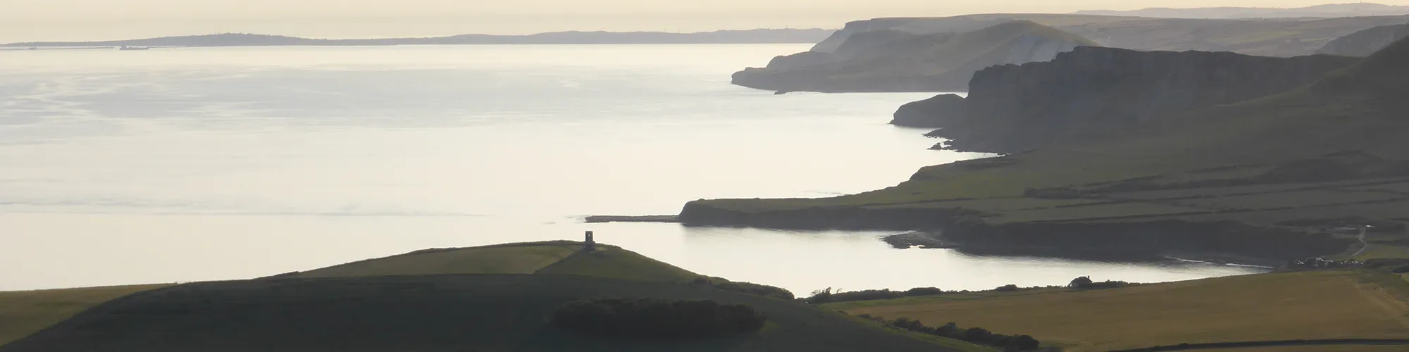
This is a challenging off-road cycling loop that begins at the historic village of Corfe Castle and takes riders deep into the rugged landscape of the Encombe Estate. The route combines a mix of tough climbs, which will really test your stamina, with fast downhill stretches that provide a thrilling reward for your efforts.
The ride includes twisting woodland single-track, demanding good bike handling skills and concentration, especially on the narrower sections where the trail winds tightly between trees. The constantly changing terrain keeps the route exciting, with a real sense of adventure as you explore one of Purbeck’s most dramatic estates.
With its combination of steep ascents, rapid descents and technical woodland riding, this loop is best suited to experienced cyclists looking for a demanding and highly rewarding off-road challenge in the heart of Purbeck.
Start:
Purbeck Park, off the A351 north of Corfe Castle. Alternative parking at the National Trust car park below Corfe Castle and join the route at #3 in the directions.
OS Reference: SY 95715 82889
These routes have been recorded using a Garmin GPS unit. We cannot guarantee the accuracy of the available data files due to differences between GPS devices.
Route
Purbeck Park
Elevation: 28 metres
OS Grid Reference: SY 95675 82902
Lat, long: 50.64579, -2.06253
Exit the car park and turn left and follow the road to the roundabout.
Roundabout
Elevation: 35 metres
OS Grid Reference: SY 95469 82827
Lat, long: 50.64511, -2.06544
Turn left at the roundabout and continue along the road down the hill and past the castle. Continue up towards the village square on your right before the traffic lights and crossing.
East Street and The Square
Elevation: 30 metres
OS Grid Reference: SY 96058 82090
Lat, long: 50.63849, -2.05711
At the village square, turn Right onto West Street and follow road to Corfe Common.
End of West Street
Elevation: 42 metres
OS Grid Reference: SY 95833 81353
Lat, long: 50.63186, -2.06028
At a cattle grid, continue straight ahead and follow narrow tarmac road to the farm
Blashenwell Farm
Elevation: 47 metres
OS Grid Reference: SY 95142 80370
Lat, long: 50.62301, -2.07003
Bear right at the farm entrance and go past the farm buildings, crossing the farm yard and the bridleway entrance is at the rear-right side of the farm yard.
Bridleway
Elevation: 51 metres
OS Grid Reference: SY 95076 80269
Lat, long: 50.62210, -2.07096
Follow the rough bridleway up the hill until you come to a metal gate on your left on a stone wall.
Metal Gate
Elevation: 120 metres
OS Grid Reference: SY 95176 79690
Lat, long: 50.61690, -2.06954
Go through the metal gate and follow the bridleway through the trees until you come to a tarmac road at Kingston Village.
Junction
Elevation: 137 metres
OS Grid Reference: SY 95472 79573
Lat, long: 50.61585, -2.06536
Turn right onto the tarmac road continue along the road in a west direction. The road changes from being under trees to open fields on each side and bears left down a hill to a small parking area on your left with a road for the Encombe Estate.
Car Park and Junction
Elevation: 145 metres
OS Grid Reference: SY 94315 79256
Lat, long: 50.61299, -2.08171
Turn left at the car parking area and go straight ahead to a gate with a bridleway sign.
Gate
Elevation: 143 metres
OS Grid Reference: SY 94321 79226
Lat, long: 50.61272, -2.08162
Go through the gate and follow the track which bears right up the hill and follow the track to the next gate.
Gate
Elevation: 169 metres
OS Grid Reference: SY 94032 78929
Lat, long: 50.61005, -2.08571
Go through the gate and follow the track up the hill towards the grass mound at Swyre Head which is the highest point on the route.
Swyre Head
Elevation: 206 metres
OS Grid Reference: SY 93393 78469
Lat, long: 50.60590, -2.09473
Swyre Head is the highest point of the route so a good place to stop to take in the view. Turn right and follow the fence line to the gate.
Gate
Elevation: 206 metres
OS Grid Reference: SY 93358 78601
Lat, long: 50.60709, -2.09522
Continue straight ahead at the gate and follow the bridleway along the ridgeline.
Gate
Elevation: 197 metres
OS Grid Reference: SY 93109 78938
Lat, long: 50.61012, -2.09875
Continue straight ahead at the gate and follow the bridleway along the ridgeline.
Gate
Elevation: 189 metres
OS Grid Reference: SY 92804 79465
Lat, long: 50.61485, -2.10307
Continue straight ahead at the gate and follow the bridleway along the ridgeline.
Gate
Elevation: 185 metres
OS Grid Reference: SY 92664 79558
Lat, long: 50.61569, -2.10505
Continue straight ahead at the gate and follow the bridleway along the ridgeline.
Gate and start of downhill
Elevation: 180 metres
OS Grid Reference: SY 92255 79752
Lat, long: 50.61743, -2.11084
Continue straight ahead at the gate and follow the bridleway down the hill to the tarmac road.
Road junction
Elevation: 109 metres
OS Grid Reference: SY 91917 80101
Lat, long: 50.62056, -2.11562
At the tarmac road, turn left and go down a small hill until you come to a T junction.
T Junction
Elevation: 101 metres
OS Grid Reference: SY 91839 80081
Lat, long: 50.62037, -2.11672
Turn right at the junction and follow the road down the hill and past a farm, continue along the road until you come to the next T junction.
T Junction
Elevation: 76 metres
OS Grid Reference: SY 91545 81155
Lat, long: 50.63003, -2.12091
Turn left at the junction and follow the road which bears right and up a steep hill until you come to a junction with a bridleway and steep chalk track on the right side.
Steep Bridleway
Elevation: 126 metres
OS Grid Reference: SY 90521 81527
Lat, long: 50.63336, -2.13538
Turn right and go up the steep bridleway until you come to a car park at the top of the hill with a gate on the right side.
Gate to Grange Arch
Elevation: 173 metres
OS Grid Reference: SY 90504 81713
Lat, long: 50.63503, -2.13563
Go through the gate and follow the track up the hill heading East until you come to a gate.
Grange Arch
Elevation: 196 metres
OS Grid Reference: SY 91263 81778
Lat, long: 50.63562, -2.12491
Grange Arch is an idea place to stop and take in the view across Dorset.
Gate
Elevation: 195 metres
OS Grid Reference: SY 91688 81823
Lat, long: 50.63604, -2.11890
Go through the gate and follow the track along the top of the hill until you come to wooden gates on the left side.
Gate and bridleway junction
Elevation: 179 metres
OS Grid Reference: SY 92266 81868
Lat, long: 50.63645, -2.11073
Go through gates and then turn Right and continue down the hill to next gate and road.
Gate and Road
Elevation: 123 metres
OS Grid Reference: SY 93010 82083
Lat, long: 50.63839, -2.10021
Turn left and follow road down the hill, straight ahead at the next junction, past a camping site and then on a left hand bend, turn right into woodland trail bridleway.
Bridleway and Singletrack
Elevation: 75 metres
OS Grid Reference: SY 93281 82844
Lat, long: 50.64524, -2.09640
Follow bridleway signs along the singletrack over a wooden bridge until you come to a campsite.
Norden Camp Site
Elevation: 42 metres
OS Grid Reference: SY 94719 82915
Lat, long: 50.64589, -2.07605
When you reach the camp site, follow the track past the campers and through the farm yard. Bear right and follow the road until you come to a T junction with the A351 road.
A351 Junction
Elevation: 35 metres
OS Grid Reference: SY 95245 82897
Lat, long: 50.64574, -2.06861
At the T junction turn Right and continue to the next roundabout (Caution this road can be very busy so take care).
Roundabout
Elevation: 31 metres
OS Grid Reference: SY 95430 82807
Lat, long: 50.64493, -2.06599
Take the first exit on the roundabout and follow the road back to the start at Purbeck Park.
Elevation Chart and Map
Move your mouse over the elevation line to view the location on the route map.
Walker & Cyclist Friendly Accommodation
Whether you’re exploring scenic trails, tackling longer routes, or simply enjoying a leisurely ride, choosing the right base makes all the difference. Below you’ll find details of some of the many local accommodation businesses that understands the needs of outdoor enthusiasts, helping you relax, recharge, and get ready for your next journey.