The Jurassic Coast
Old Harry marks the eastern end of England's only natural World Heritage Site, stretching 95 miles to Devon.
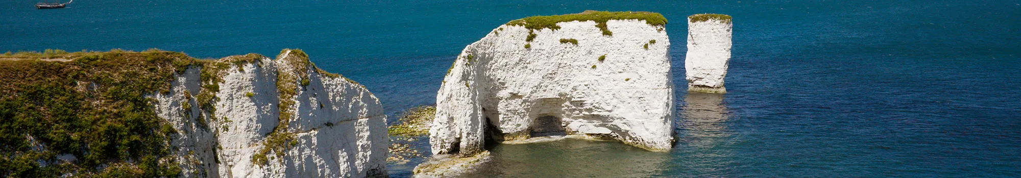
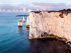
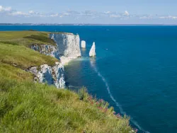
The dazzling white chalk sea stacks at Handfast Point - the dramatic eastern gateway to the Jurassic Coast, where the Purbeck hills finally meet the sea.
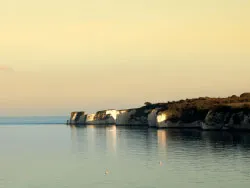
Two miles north-east of Swanage and a mile east of Studland, a line of brilliant white chalk pillars marches out into the English Channel. These are Old Harry Rocks.
Old Harry Rocks are a small group of chalk stacks, stumps and a natural arch standing just off Handfast Point, at the seaward end of Ballard Down. They mark the most easterly point of the Jurassic Coast - England's only natural World Heritage Site - and the spot where the long chalk ridge of the Purbeck Hills runs out of land. The pure white of the chalk against the deep blue and turquoise of the sea makes this one of the most photographed views in Dorset, and a magnet for walkers, cyclists, sea kayakers and artists alike.
The land here belongs largely to the National Trust, and the easy bridleway out to the headland is one of the gentlest ways in the country to reach such a dramatic coastal viewpoint. On a clear day the views stretch east across the water to the Needles on the Isle of Wight - Old Harry's geological cousins - and west along the cliffs towards Swanage Bay.

The chalk here was laid down in a warm, shallow sea during the Late Cretaceous period, roughly 65 to 85 million years ago, from the compacted remains of countless tiny marine organisms. It once formed a continuous ridge that stretched from the Isle of Purbeck across to the Isle of Wight, linking Ballard Down with the Needles. Until only a few thousand years ago, after the last Ice Age, as sea levels rose and flooded the gap that became the Solent, you could have walked the whole way along it.
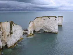
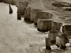
The stacks themselves are a textbook example of coastal erosion. The sea attacks weaknesses in the chalk through hydraulic action, forcing water and air into cracks and joints. A crack becomes a cave, the cave is driven through the headland to form an arch, and eventually the unsupported top of the arch collapses, leaving an isolated pillar, or stack, standing offshore. When a stack is undercut and topples, only a low stump remains. Every feature here, from the arch to the stumps, is a different stage of that same slow process.
It is a living, changing landscape. People could still walk out to Old Harry from the mainland in the 1770s, and the stack known as "Old Harry's Wife" lost its top and became a stump within the last couple of centuries. Erosion continues today, so the rocks you see now are simply this century's version of an ever-shifting headland.

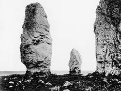
Strictly speaking, "Old Harry" is just one of the rocks, the tall, isolated stack furthest out to sea. The low stump beside it is known as "Old Harry's Wife," though confusingly she is at least his second: an earlier wife is recorded as having collapsed into the sea centuries ago. Other features in the group have their own names too, including the gap called St Lucas' Leap.
Nobody is entirely sure how the rocks got their name, and there are two competing legends. One holds that "Old Harry" is an old euphemism for the Devil, who is said to have once slept on the rocks, a story echoed by nearby clifftop ground traditionally called "Old Nick's Ground," Old Nick being another name for the Devil. The other story credits Harry Paye, a notorious 14th and 15th century pirate and privateer from Poole, who is said to have lurked behind the stacks to ambush passing merchant ships and stash his contraband in the sea caves.
Both tales are folklore rather than documented history, and you'll find locals who swear by each. Harry Paye, at least, was certainly real, he is still celebrated in Poole with an annual "Harry Paye Day" charity festival on the quay.

The isolation of the stacks and the sheer cliffs make them an ideal refuge for breeding seabirds, safe from ground predators. Gulls, including the huge greater black-backed gull, Britain's largest, roost and nest on the pillars, riding the up-draughts along the cliff edge, and peregrine falcons hunt the headland. Look down into the clear water around the rocks and you may spot seals; the wider Studland coast is also known for seahorses in its seagrass beds.
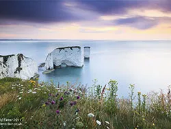
The headland of Handfast Point and the slopes of Ballard Down are chalk grassland, a habitat that supports a rich array of wildflowers and the insects and birds that depend on them. In spring and summer the turf is dotted with colour, and skylarks sing overhead. The grassland here is part of what makes this stretch of coast a protected landscape as well as a geological one.
Because the stacks are wildlife havens and the cliffs are fragile and unfenced, the rocks are best enjoyed from the clifftop paths or from the water as there is no safe way to reach the stacks themselves on foot.

The classic approach starts in Studland village. From the National Trust car park near the Bankes Arms, a level gravel bridleway leads out to the headland in around a mile, about 20 minutes' easy walking, suitable for most abilities, though the cliff edges at the point are sheer and unfenced. This is the simplest way to reach the viewpoint and take in the rocks at close range.
For a fuller day, the popular circular route of roughly 3.5 to 4 miles loops out to Old Harry and then climbs the ridge of Ballard Down before dropping back to Studland. It rewards one steady climb with sweeping views: Swanage Bay to the south, and Studland, Sandbanks, Brownsea Island and Poole Harbour to the north. The down is also dotted with Bronze Age burial barrows, a reminder that people have walked this ridge for thousands of years.
Old Harry sits on the South West Coast Path, so you can also walk the dramatic clifftop route on to Swanage (around 4–5 miles), or strike out the other way along the full sweep of Studland Bay. The headland is part of the same ridge walk that connects Swanage to Studland via Ballard Down, one of the finest coastal walks in southern England.

The headland sits at the meeting point of some of Purbeck's best-loved coast and countryside.
Old Harry marks the eastern end of England's only natural World Heritage Site, stretching 95 miles to Devon.
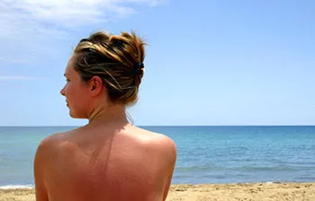
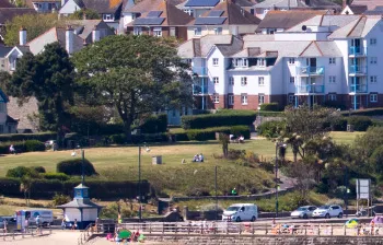
The nearest village, with miles of golden sandy beach, dune heath, a country pub and the start of the walk.
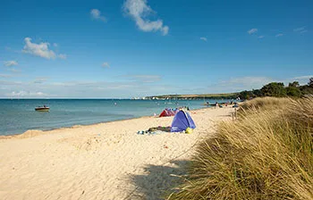
Sheltered, shallow, blue-flag sand backed by dunes — perfect for a swim to round off the walk.
Sources used for the geology, history, wildlife and walking information added to this page: