Encombe, Creech, Corfe Loop
Cycling Route
Type: Off Road Ride
Distance: 12 miles
Total Ascent: 425m (1400 feet) approx
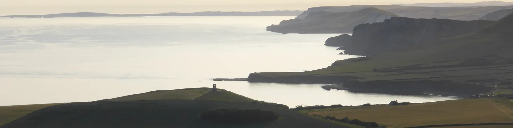
![]() Starting location:
Starting location:
Purbeck Park, off the A351 north of Corfe Castle. Alternative parking at the National Trust car park below Corfe Castle and join the route at #3 in the directions.
OS Reference: SY 95715 82889
Description:
A challenging loop with some hard climbs, fast downhill sections and twisting woodland single-track.
These routes have been recorded using a Garmin GPS unit. We cannot guarantee the accuracy of the available data files due to differences between GPS devices.
Route
1 - Purbeck Park - Exit the car park and turn left and follow the road to the roundabout.
2 - Roundabout - Turn left at the roundabout and continue along the road down the hill and past the castle. Continue up towards the village square on your right before the traffic lights and crossing.
3 - East Street and The Square - At the village square, turn Right onto West Street and follow road to Corfe Common.
4 - End of West Street - At a cattle grid, continue straight ahead and follow narrow tarmac road to the farm
5 - Blashenwell Farm - Bare right at the farm entrance and go past the farm buildings, crossing the farm yard and the bridleway entrance is at the rear-right side of the farm yard.
6 - Bridleway - Follow the rough bridleway up the hill until you come to a metal gate on your left on a stone wall.
7 - Metal Gate - Go through the metal gate and follow the bridleway through the trees until you come to a tarmac road at Kingston Village.
8 - Junction - Turn right onto the tarmac road continue along the road in a west direction. The road changes from being under trees to open fields on each side and bares left down a hill to a small parking area on your left with a road for the Encombe Estate.
9 - Car Park and Junction - Turn left at the car parking area and go straight ahead to a gate with a bridleway sign.
10 - Gate - Go through the gate and follow the track which bares right up the hill and follow the track to the next gate.
11 - Gate - Go through the gate and follow the track up the hill towards the grass mound at Swyre Head which is the highest point on the route.
12 - Swyre Head - Swyre Head is the highest point of the route so a good place to stop to take in the view. Turn right and follow the fence line to the gate.
13 - Gate - Continue straight ahead at the gate and follow the bridleway along the ridgeline.
14 - Gate - Continue straight ahead at the gate and follow the bridleway along the ridgeline.
15 - Gate - Continue straight ahead at the gate and follow the bridleway along the ridgeline.
16 - Gate - Continue straight ahead at the gate and follow the bridleway along the ridgeline.
17 - Gate and start of downhill - Continue straight ahead at the gate and follow the bridleway down the hill to the tarmac road.
18 - Road junction - At the tarmac road, turn left and go down a small hill until you come to a T junction.
19 - T Junction - Turn right at the junction and follow the road down the hill and past a farm, continue along the road until you come to the next T junction.
20 - T Junction - Turn left at the junction and follow the road which bares right and up a steep hill until you come to a junction with a bridleway and steep chalk track on the right side.
21 - Steep Bridleway - Turn right and go up the steep bridleway until you come to a car park at the top of the hill with a gate on the right side.
22 - Gate to Grange Arch - Go through the gate and follow the track up the hill heading East until you come to a gate.
23 - Grange Arch - Grange Arch is an idea place to stop and take in the view across Dorset.
24 - Gate - Go through the gate and follow the track along the top of the hill until you come to wooden gates on the left side.
25 - Gate and bridleway junction - Go through gates and then turn Right and continue down the hill to next gate and road.
26 - Gate and Road - Turn left and follow road down the hill, straight ahead at the next junction, past a camping site and then on a left hand bend, turn right into woodland trail bridleway.
27 - Bridleway and Singletrack - Follow bridleway signs along the singletrack over a wooden bridge until you come to a campsite.
28 - Norden Camp Site - When you reach the camp site, follow the track past the campers and through the farm yard. Bare right and follow the road until you come to a T junction with the A351 road.
29 - A351 Junction - At the T junction turn Right and continue to the next roundabout (Caution this road can be very busy so take care).
30 - Roundabout - Take the first exit on the roundabout and follow the road back to the start at Purbeck Park.
Elevation Chart and Map
Move your mouse over the elevation line to view the location on the route map.