Chapmans Pool to Houns Tout
Walking Route
Type: Walk
Distance: 3.5 miles
Total Ascent: 150m (approx)
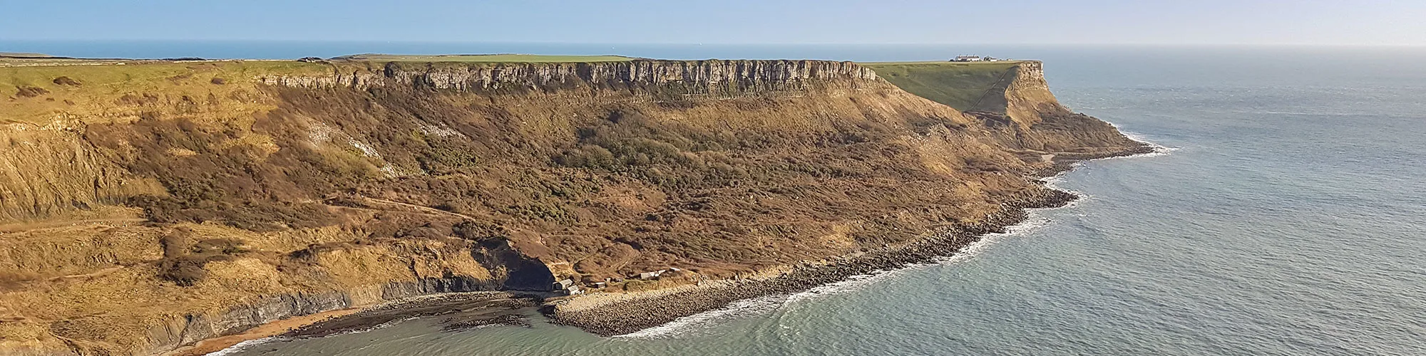
![]() Starting location:
Starting location:
OSGB Grid Ref: SY 95353 79459 near Kingston Village, N50° 36.894' W2° 04.023'
Description:
A hilly 3.5 mile walk along good tracks and paths down to Chapmans Pool then up steep steps to the top of Houns Tout returning along the ridgeline to Kingston Village carpark. Some sections can be muddy in winter. The walk offers views across the Jurassic Coast. Parking is available in a small free carpark to the West of Kingston Village
These routes have been recorded using a Garmin GPS unit. We cannot guarantee the accuracy of the available data files due to differences between GPS devices.
Route
1 - Start at Car Park - Start at the car park located at OS Grid Ref SY 95353 79459 to the west of Kingston Village. Exit the Car Park back to the road
2 - Road Junction - Turn right at the road and continue along the road into Kingston village. Continue until you come to the church on your right and a junction on the right side of the road.
3 - South Street Junction - Turn Right onto South Street and follow the road up the hill past the church and continue along the road past trees until the road turns right with a gate and style straight ahead
4 - South Street and unpaved road - Go straight ahead over the stile and follow the track down the hill. When the track starts to go to the right you will find a stile on your right side which takes you into a field.
5 - Stile - Go over the stile and turn left and follow the footpath heading South across the field to the next stile.
6 - Stile - Go over the stile and turn right and follow the steep path up the hill. The first section can be muddy in winter and this leads to steps which take you to the top of the hill. Please take care on this section as it is very close to the cliff edge. Follow the path until you come to a stone seat overlooking the coast to your west. This is a good place for a rest and take in the views of the Jurassic Coast.
7 - Stone Bench - At the stone bench turn right and follow a short path to the stile next to a stone wall. Go over the stile and follow the path alongside the stone wall over the next stile until you come to a gate and stile leading into woodland.
8 - Stile and Woodland - Go over the stile and follow the wide track heading North back to the car park
Elevation Chart and Map
Move your mouse over the elevation line to view the location on the route map.